MyTopo
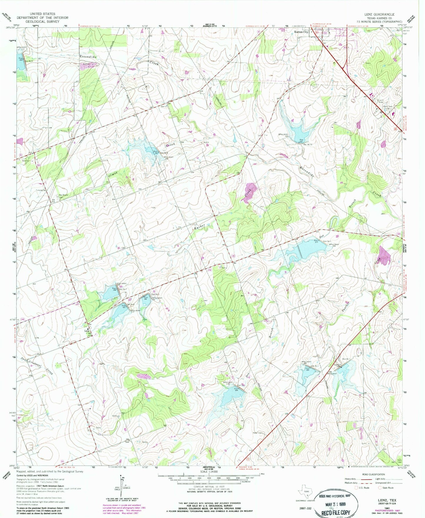
Classic USGS Lenz Texas 7.5'x7.5' Topo Map
Couldn't load pickup availability
Historical USGS topographic quad map of Lenz in the state of Texas. Map scale may vary for some years, but is generally around 1:24,000. Print size is approximately 24" x 27"
This quadrangle is in the following counties: Karnes.
The map contains contour lines, roads, rivers, towns, and lakes. Printed on high-quality waterproof paper with UV fade-resistant inks, and shipped rolled.
Contains the following named places: Bucker Creek, Dam Number 1, Dam Number 10, Dam Number 2, Dam Number 3, Dam Number 4, Dam Number 5, Dam Number 6, Dam Number 7, Dam Number 8, Dam Number 9, Doe Branch, KAML-AM (Kenedy-Karnes City), Karnes City Division, Karnes County Museum at Old Helena, Lenz, New Bremen Cemetery, Olmos Creek, Otto Kaiser Hospital Heliport, Otto Kaiser Memorial Hospital, Soil Conservation Service Site 1 Dam, Soil Conservation Service Site 1 Reservoir, Soil Conservation Service Site 10 Dam, Soil Conservation Service Site 10 Reservoir, Soil Conservation Service Site 12 Dam, Soil Conservation Service Site 12 Reservoir, Soil Conservation Service Site 13 Dam, Soil Conservation Service Site 13 Reservoir, Soil Conservation Service Site 2 Dam, Soil Conservation Service Site 2 Reservoir, Soil Conservation Service Site 3 Dam, Soil Conservation Service Site 3 Reservoir, Soil Conservation Service Site 4 Dam, Soil Conservation Service Site 4 Reservoir, Soil Conservation Service Site 5 Dam, Soil Conservation Service Site 5 Reservoir, Soil Conservation Service Site 6 Dam, Soil Conservation Service Site 6 Reservoir, Soil Conservation Service Site 7 Dam, Soil Conservation Service Site 7 Reservoir, Soil Conservation Service Site 8 Dam, Soil Conservation Service Site 8 Reservoir, Soil Conservation Service Site 9 Dam