
MyTopo
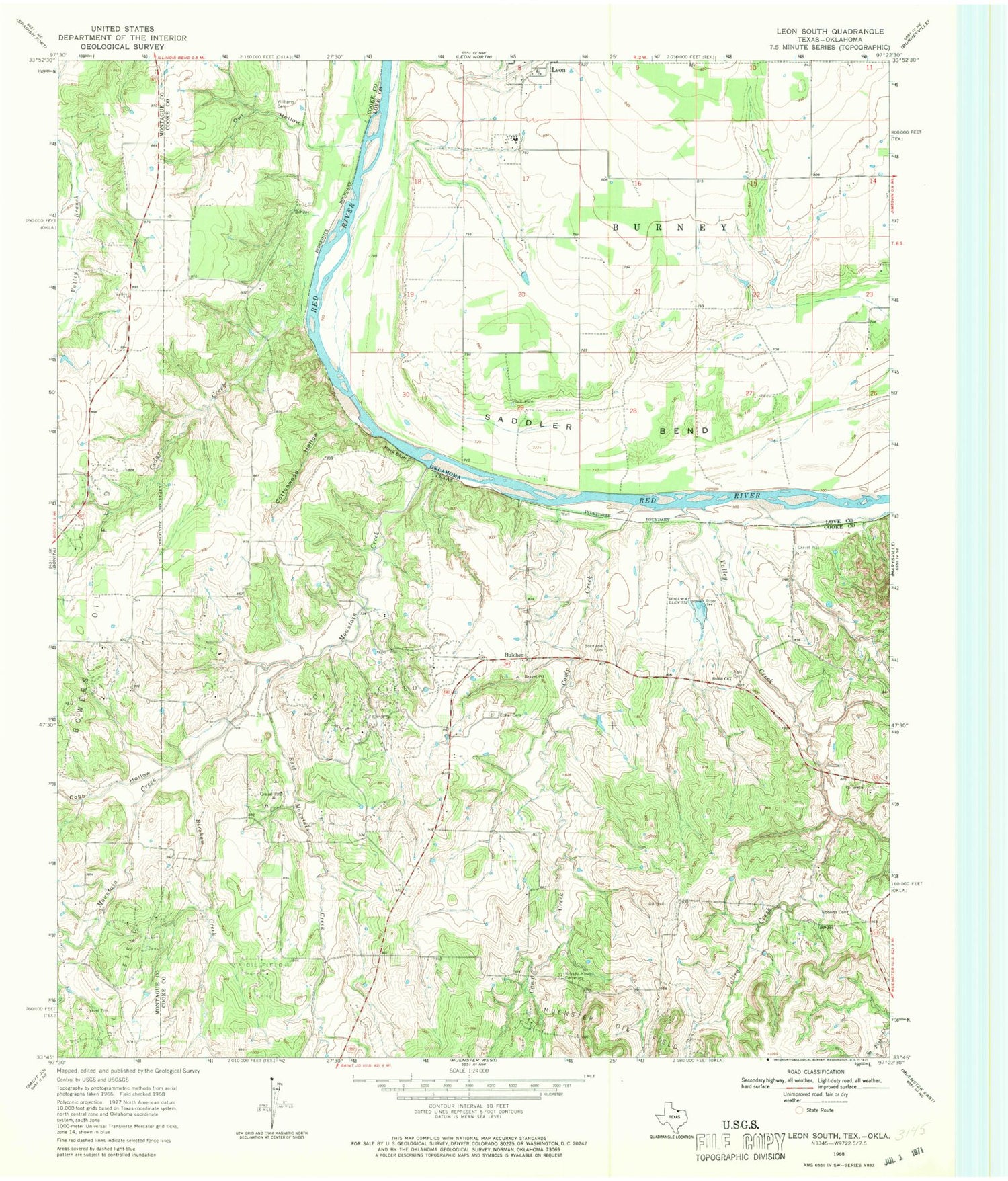
Classic USGS Leon South Oklahoma 7.5'x7.5' Topo Map
Couldn't load pickup availability
Historical USGS topographic quad map of Leon South in the states of Oklahoma, Texas. Map scale may vary for some years, but is generally around 1:24,000. Print size is approximately 24" x 27"
This quadrangle is in the following counties: Cooke, Love, Montague.
The map contains contour lines, roads, rivers, towns, and lakes. Printed on high-quality waterproof paper with UV fade-resistant inks, and shipped rolled.
Contains the following named places: Able Cemetery, Bircham Creek, Brushy Mound Cemetery, Bulcher, Camp Creek, Cedar Creek, Cobb Hollow, Coker Cemetery, East Mountain Creek, Mountain Creek, Owl Hollow, Roberts Cemetery, Rock Bluff, Saddler Bend, Scanland Cemetery, Shiloh Church, Valley Creek, Williams Cemetery


