MyTopo
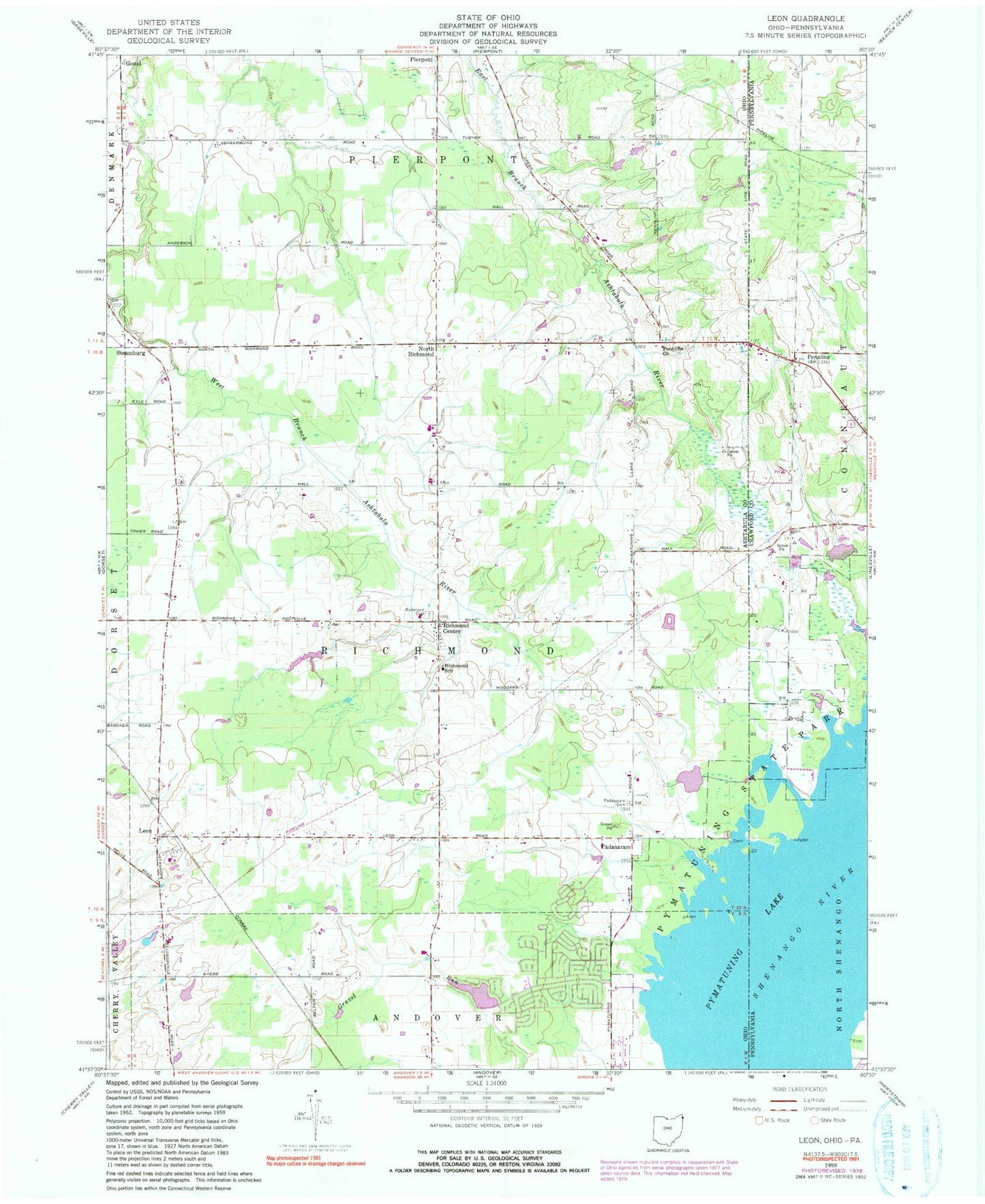
Classic USGS Leon Ohio 7.5'x7.5' Topo Map
Couldn't load pickup availability
Historical USGS topographic quad map of Leon in the states of Ohio, Pennsylvania. Map scale may vary for some years, but is generally around 1:24,000. Print size is approximately 24" x 27"
This quadrangle is in the following counties: Ashtabula, Crawford.
The map contains contour lines, roads, rivers, towns, and lakes. Printed on high-quality waterproof paper with UV fade-resistant inks, and shipped rolled.
Contains the following named places: Anderson, Barber Cemetery, Beckwith Dairy, Boggs Dairy Farm, Boleratzs Farm, Dart Cemetery, Gould, Harvey Farms, Holiday Camplands Lake, Holiday Camplands Lake Dam, Holiday Camplands Volunteer Fire Department, Kettunen Farm, Leon, Leon Post Office, Lonesome Pine Farm, North Richmond, Oak Swampy Farm, Padanaram, Padanaram Cemetery, Padanarum Post Office, Penn Line Cemetery, Pennline, Pennline Church, Pierpont, Pierpont Centre Post Office, Pyma-Love Airport, Pymatuning State Park, Pymatuning Swamp, Richmond Center, Richmond Center Cemetery, Richmond Center Post Office, Richmond School, Sharpe Farm, Skyview Farm, Steamburg, Steamburg Church, Steamburg Post Office, Township of Richmond, Windblown Acres, Woodard Farms