MyTopo
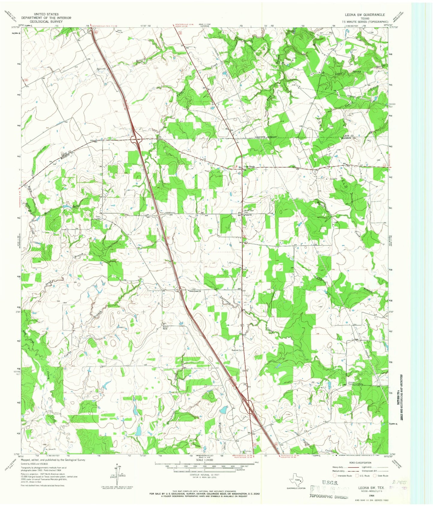
Classic USGS Leona SW Texas 7.5'x7.5' Topo Map
Couldn't load pickup availability
Historical USGS topographic quad map of Leona SW in the state of Texas. Map scale may vary for some years, but is generally around 1:24,000. Print size is approximately 24" x 27"
This quadrangle is in the following counties: Leon, Madison.
The map contains contour lines, roads, rivers, towns, and lakes. Printed on high-quality waterproof paper with UV fade-resistant inks, and shipped rolled.
Contains the following named places: Buck Gully, Concord Community Building, Coplin Branch, Cross Roads, Fisherman Paradise Lake, Fisherman Paradise Lake Dam, Greenbriar Cemetery, Greer Cemetery, Hensarling Airport, Leon Creek, Middle Branch Riley Creek, Mount Tabor Cemetery, OSR Oil Field, Riley Creek, Sand Branch, Seven J Ranch, Spring Branch, Sweet Home Church, Tabor Church, Walker Lake Number 1, Walker Lake Number 1 Dam, Walker Lake Number 2, Walker Lake Number 2 Dam