MyTopo
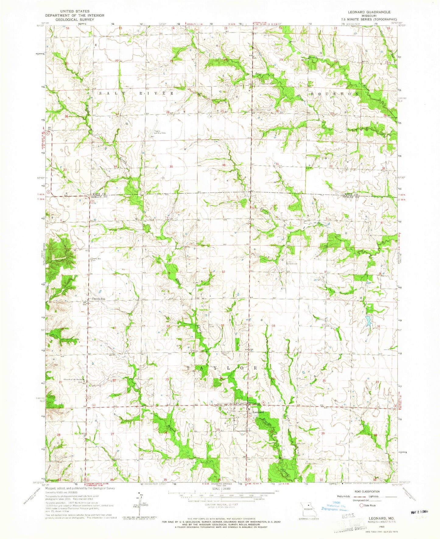
Classic USGS Leonard Missouri 7.5'x7.5' Topo Map
Couldn't load pickup availability
Historical USGS topographic quad map of Leonard in the state of Missouri. Map scale may vary for some years, but is generally around 1:24,000. Print size is approximately 24" x 27"
This quadrangle is in the following counties: Knox, Shelby.
The map contains contour lines, roads, rivers, towns, and lakes. Printed on high-quality waterproof paper with UV fade-resistant inks, and shipped rolled.
Contains the following named places: Antioch Cemetery, Browning Lake Dam, Caldwell Lake Section 6 Dam, Caldwell Lake Section 7 Dam, Cherry Box, Cherry Box Cemetery, Cherry Box School, Church of the Brethren, Cockrum Cemetery, Fairview School, Garnett Cemetery, Gray Branch, Gray Cemetery, Gray School, Grubb College School, Hilton Branch, Leonard, Leonard Christian Church, Leonard Post Office, McWilliams School, Mennonite Church, Millers Mill, Mote School, New Providence Church, Peoples Cemetery, Rhoades School, Shortfall School, Township of Taylor, Village of Leonard, Washington School, ZIP Codes: 63451, 63460