MyTopo
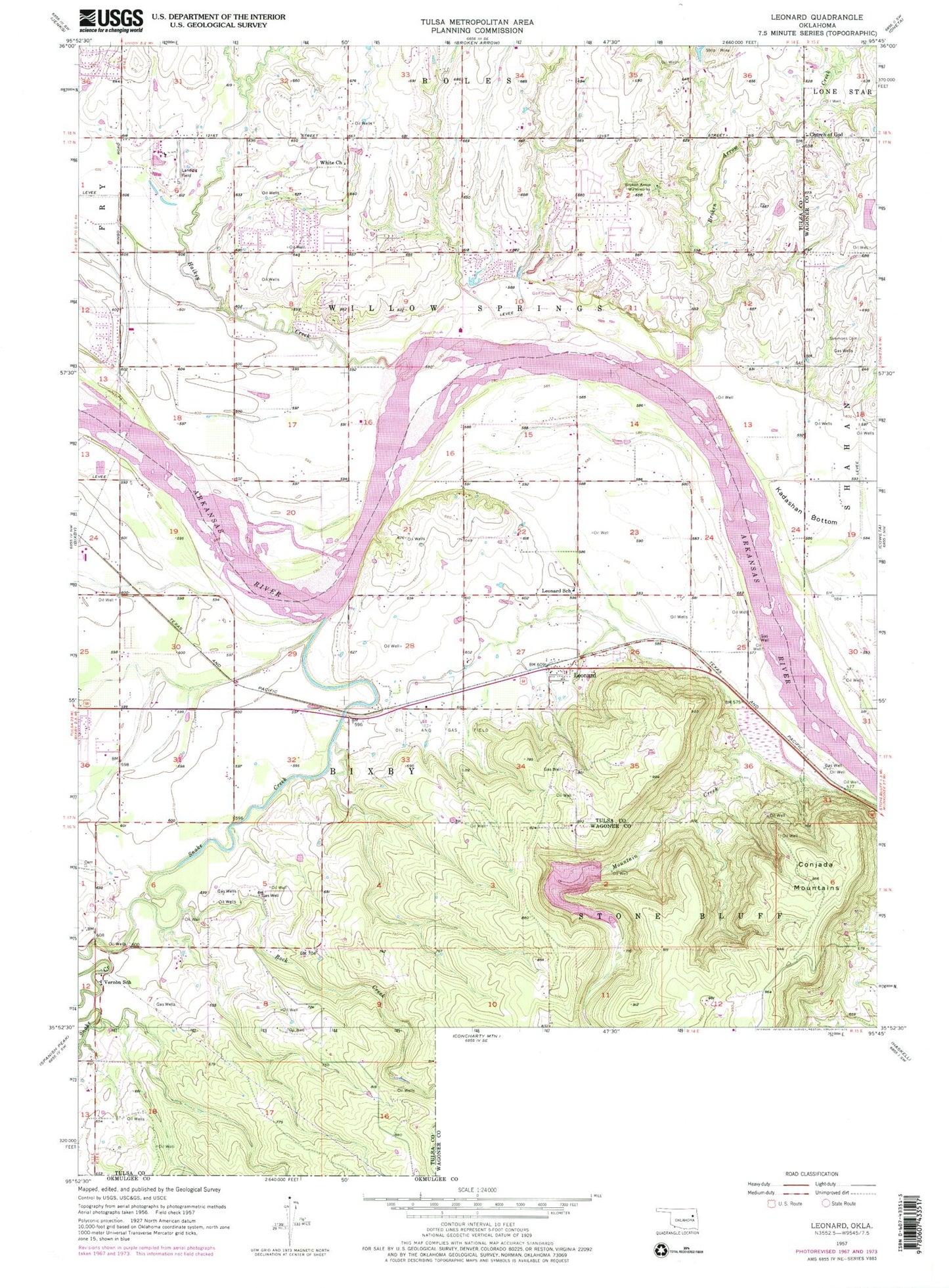
Classic USGS Leonard Oklahoma 7.5'x7.5' Topo Map
Couldn't load pickup availability
Historical USGS topographic quad map of Leonard in the state of Oklahoma. Map scale may vary for some years, but is generally around 1:24,000. Print size is approximately 24" x 27"
This quadrangle is in the following counties: Tulsa, Wagoner.
The map contains contour lines, roads, rivers, towns, and lakes. Printed on high-quality waterproof paper with UV fade-resistant inks, and shipped rolled.
Contains the following named places: Apueka Cemetery, Aspen Park Baptist Church, Bible Baptist Church, Bixhoma Dam, Bixhoma Lake, Broken Arrow Fire Department Station 3, Broken Arrow Waterworks, Childers Middle School, Conjada Mountains, Grace Free Will Baptist Church, Hailkey Creek, Indian Springs Baptist Church, Indian Springs Elementary School, Indian Springs Plaza, KAKC-AM (Tulsa), Leonard, Leonard Census Designated Place, Leonard Christian Fellowship Church, Leonard Elementary School, Leonard Post Office, Lockridge Cemetery, Sanger Cemetery, Shepherd of the Hills Church, Simmons Cemetery, Snake Creek, Snake Creek Cemetery, Spring Creek Elementary School, Township of Bixby, Township of Willow Springs, Trinity Lutheran Church, Vernon School, White Church, ZIP Code: 74011