MyTopo
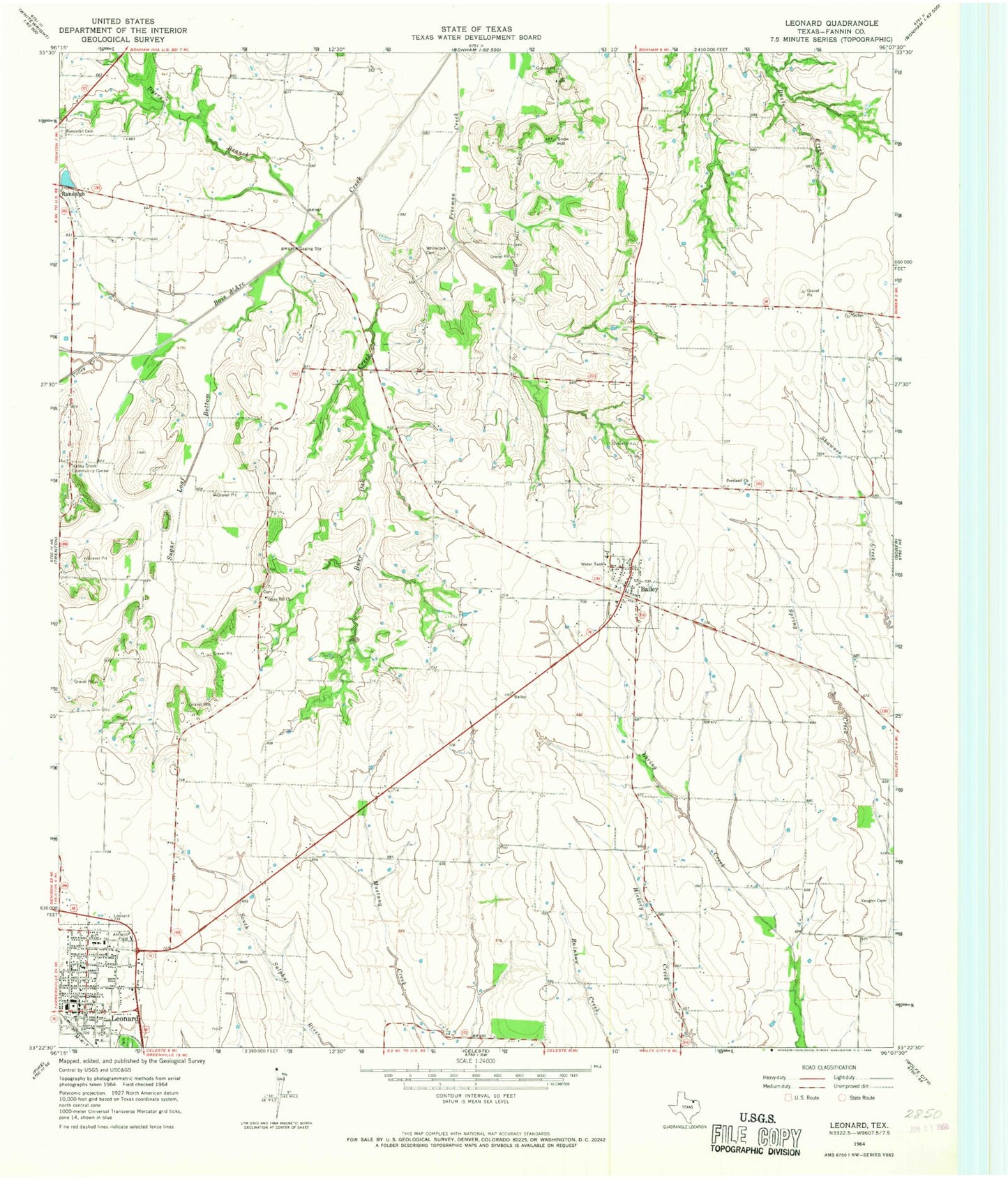
Classic USGS Leonard Texas 7.5'x7.5' Topo Map
Couldn't load pickup availability
Historical USGS topographic quad map of Leonard in the state of Texas. Map scale may vary for some years, but is generally around 1:24,000. Print size is approximately 24" x 27"
This quadrangle is in the following counties: Fannin.
The map contains contour lines, roads, rivers, towns, and lakes. Printed on high-quality waterproof paper with UV fade-resistant inks, and shipped rolled.
Contains the following named places: Bailey, Bailey City Hall, Bailey Post Office, Bailey Volunteer Fire Department, Burr Oak Creek, City of Bailey, City of Leonard, Correa Lake, Correa Lake Dam, Doyle Family Cemetery, Dyers Branch, Fannin County Constable's Office Precinct 2, First Baptist Church of Leonard, First Christian Academy of Leonard, Gilbert Lake, Gilbert Lake Dam, Grove Hill Airport, Grove Hill Cemetery, Grove Hill Church, Leonard, Leonard City Hall, Leonard Division, Leonard High School, Leonard Junior High School, Leonard Police Department, Leonard Post Office, Leonard Volunteer Fire Department, Portland Church, Purdue Lake, Purdue Lake Dam, Randolph Cemetery, Snow Hill, Sugar Loaf Bottom, Taylor Dam, Taylor Lake, Texas No Name Number 32 Dam, Texas No Name Number 33 Dam, Valley Creek, Valley Creek Community Center, Vaughn Family Cemetery, White Rock Cemetery, ZIP Codes: 75413, 75452, 75475