MyTopo
Classic USGS Lequire Oklahoma 7.5'x7.5' Topo Map
Couldn't load pickup availability
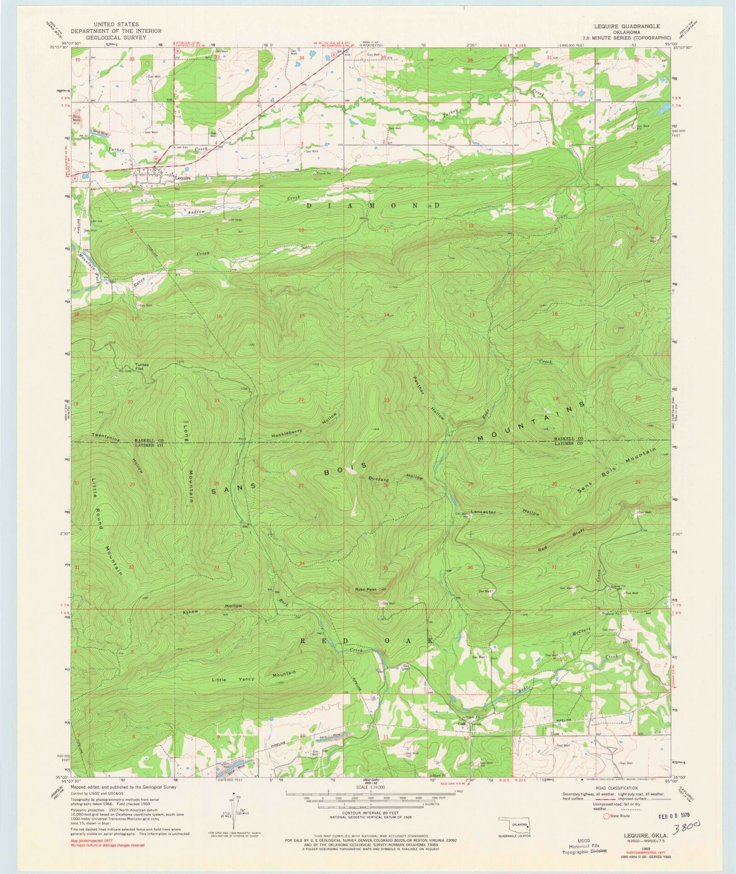
Historical USGS topographic quad map of Lequire in the state of Oklahoma. Map scale may vary for some years, but is generally around 1:24,000. Print size is approximately 24" x 27"
This quadrangle is in the following counties: Haskell, Latimer.
The map contains contour lines, roads, rivers, towns, and lakes. Printed on high-quality waterproof paper with UV fade-resistant inks, and shipped rolled.
Contains the following named places: Askew Hollow, Buzzard Hollow, Cowden Laterals Site 12 Dam, Cowden Laterals Site 12 Reservoir, Eaton Creek, Huckleberry Hollow, Lancaster Hollow, Lequire, Lequire Census Designated Place, Lequire Post Office, Lequire Volunteer Fire Department, Little Round Mountain, Little Yancy Mountain, Lodi, Long Mountain, McClure Creek, Oknoname 361001 Dam, Oknoname 361001 Reservoir, Panther Hollow, Red Bluff, Ryan Peak, Township of Diamond, Turkey Flat, ZIP Code: 74943