MyTopo
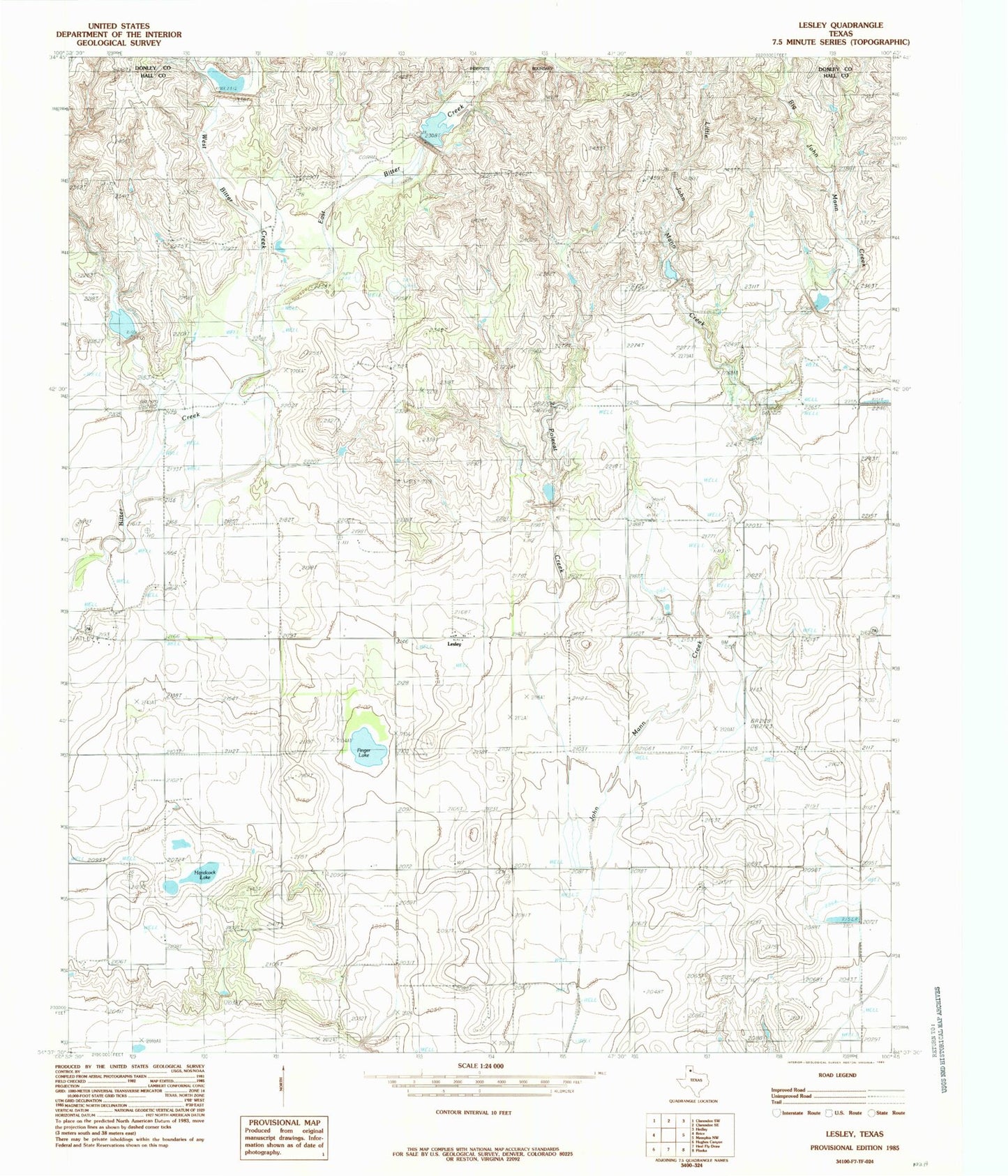
Classic USGS Lesley Texas 7.5'x7.5' Topo Map
Couldn't load pickup availability
Historical USGS topographic quad map of Lesley in the state of Texas. Map scale may vary for some years, but is generally around 1:24,000. Print size is approximately 24" x 27"
This quadrangle is in the following counties: Donley, Hall.
The map contains contour lines, roads, rivers, towns, and lakes. Printed on high-quality waterproof paper with UV fade-resistant inks, and shipped rolled.
Contains the following named places: Big John Mann Creek, East Bitter Creek, Finger Lake, Hancock Lake, Lakeview Division, Lesley, Little John Mann Creek, Soil Conservation Service Site 101 Reservoir, Soil Conservation Service Site 107 Dam, Soil Conservation Service Site 107 Reservoir, Soil Conservation Service Site 3 Dam, Soil Conservation Service Site 3 Reservoir, Soil Conservation Service Site 4 Dam, Soil Conservation Service Site 4 Reservoir, Soil Conservation Service Site 5 Dam, Soil Conservation Service Site 5 Reservoir, Soil Conservation Service Site 6 Dam, Soil Conservation Service Site 6 Reservoir, Soil Conservation Service Site 7 Dam, Soil Conservation Service Site 7 Reservoir, Soil Conservation Service Site 8 Dam, Soil Conservation Service Site 8 Reservoir, Soil Conservation Service Site Number 101 Dam, Soil Conservation Service Site Number 102 Dam, Soil Conservation Service Site Number 102 Reservoir, Soil Conservation Service Site Number 103 Dam, Soil Conservation Service Site Number 103 Reservoir, West Bitter Creek, ZIP Code: 79239