MyTopo
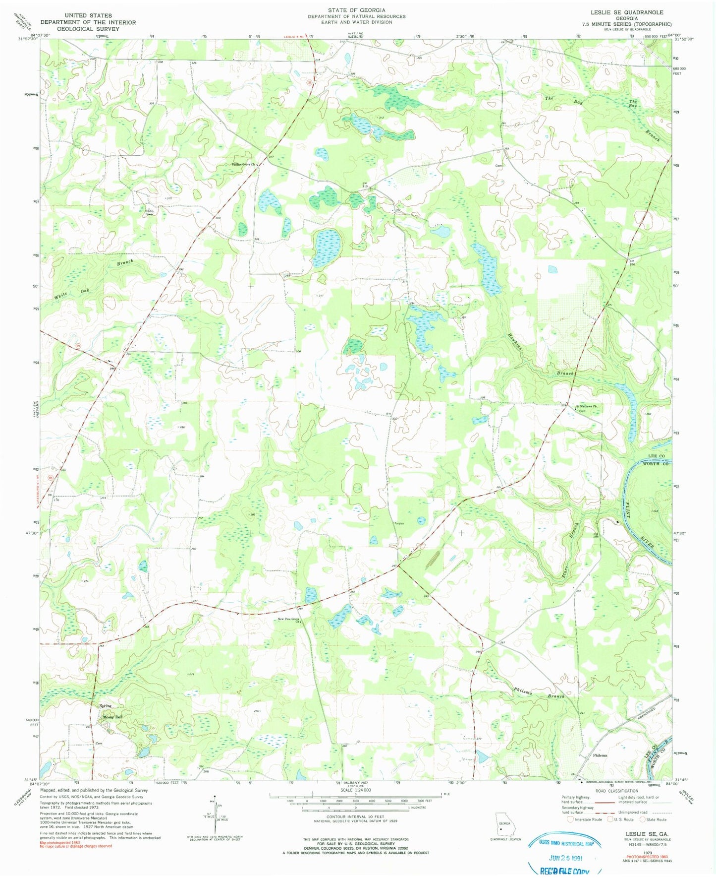
Classic USGS Leslie SE Georgia 7.5'x7.5' Topo Map
Couldn't load pickup availability
Historical USGS topographic quad map of Leslie SE in the state of Georgia. Map scale may vary for some years, but is generally around 1:24,000. Print size is approximately 24" x 27"
This quadrangle is in the following counties: Lee, Worth.
The map contains contour lines, roads, rivers, towns, and lakes. Printed on high-quality waterproof paper with UV fade-resistant inks, and shipped rolled.
Contains the following named places: Antioch Church, Bodrey Lake, Bodrey Lake Dam, Chokee School, Hawkins Branch, Heath School, Larramore Cemetery, Lee County Fire Department Station 6 Chokee 1, Lee County Fire Department Station 7 Chokee 2, Liramores Store, Mossy Dell, Mossy Dell Dam, Mossy Dell Lake, Mount Middleton Church, New Pine Grove Church, Philema, Philema Division, Phillips Grove Church, Saint Mathews Church, Starr Branch, The Bay, United States Pecan Field Station