MyTopo
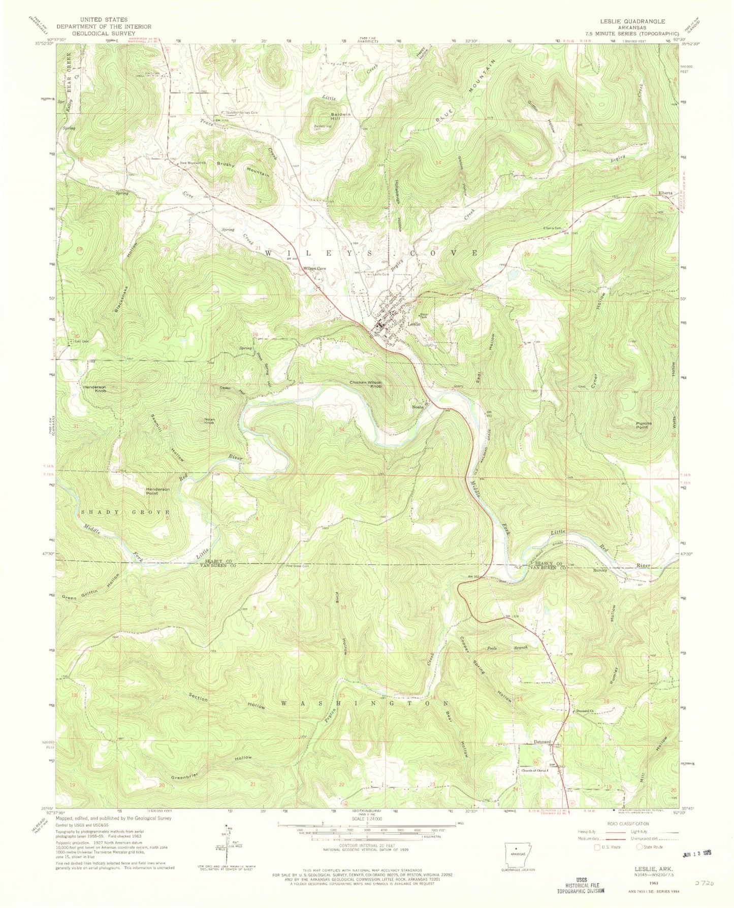
Classic USGS Leslie Arkansas 7.5'x7.5' Topo Map
Couldn't load pickup availability
Historical USGS topographic quad map of Leslie in the state of Arkansas. Map scale may vary for some years, but is generally around 1:24,000. Print size is approximately 24" x 27"
This quadrangle is in the following counties: Searcy, Van Buren.
The map contains contour lines, roads, rivers, towns, and lakes. Printed on high-quality waterproof paper with UV fade-resistant inks, and shipped rolled.
Contains the following named places: Ashley Mill, Baker Lake, Baker Lake Dam, Baldwin Hill, Baldwin Hill Cemetery, Bear Hollow, Begley Creek, Blacksnake Hollow, Blue Mountain, Brushy Mountain, Caid Cemetery, Cedar Hollow, Chicken Wilson Knob, Church of Christ, City of Leslie, Copper Spring Hollow, Cove Creek, Dennard, Dennard Cemetery, Dennard Church, Dennard Post Office, Dennard School, Dennard Volunteer Fire Department, Eadl Hollow, Elberta, Elberta Cemetery, Gibbins Hollow, Green Griffin Hollow, Greenbrier Hollow, Griffin Hollow, Happy Hollow, Henderson Knob, Henderson Point, Hollabaugh Hollow, Horn Cemetery, Kelley Creek, Kimbrell Creek, King Hollow, Leslie, Leslie Cemetery, Leslie Fire Department, Leslie High School, Leslie Intermediate School, Leslie Post Office, Little Creek, New Hopewell Church, Noahs, Nolan Knob, Oak Flat, Peyton Creek, Pine Grove Cemetery, Pipkins Point, Poole Branch, Rumley, Rumley Hollow, Sawmill Hollow, Section Hollow, Sulphur Springs Cemetery, Township of Wileys Cove, Trace Creek, Watts Hollow, West Spring Hollow, Wileys Cove, ZIP Code: 72645