MyTopo
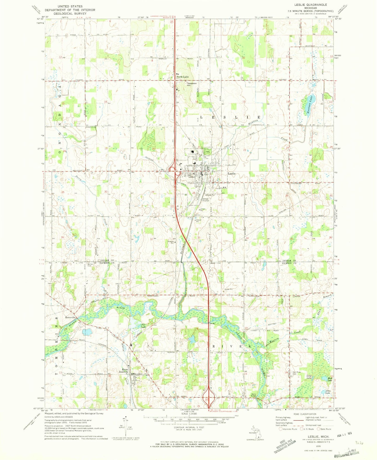
Classic USGS Leslie Michigan 7.5'x7.5' Topo Map
Couldn't load pickup availability
Historical USGS topographic quad map of Leslie in the state of Michigan. Map scale may vary for some years, but is generally around 1:24,000. Print size is approximately 24" x 27"
This quadrangle is in the following counties: Ingham, Jackson.
The map contains contour lines, roads, rivers, towns, and lakes. Printed on high-quality waterproof paper with UV fade-resistant inks, and shipped rolled.
Contains the following named places: Albrow Creek, Allen Lake, Berry Bridge, Berryville, Bible Baptist Church, City of Leslie, Congregational United Church, Craddock Drain, East Rives Cemetery, Faith Assembly of God Church, First Baptist Church Historical Marker, Foote Family Medical Center, Fox Lake, Grace Lutheran Church, Grand River Community Church, Hunton Creek, Hunton Lake, Kingdom Hall of Jehovah's Witnesses, Leslie, Leslie Ambulance Service, Leslie City Hall, Leslie City Library, Leslie Estates Mobile Home Park, Leslie Fire Department, Leslie First Baptist Church, Leslie High School, Leslie Middle School, Leslie Police Department, Leslie Post Office, Leslie Station, Leslie United Methodist Church, Long Lake, Mud Lake, North Leslie, North Leslie Post Office, Perry Creek, Pleasant Lake Drain, Rives / Tompkins Fire Department Station 1 Headquarters, Rives / Tompkins Fire Department Station 3, Rives Baptist Church, Rives Junction, Rives Junction Post Office, Rives Junction Station, Rives Township Memorial Cemetery, Rives Wesleyan Church, Royston Drain, Shaw Branch, Teaspoon Hill, Township of Leslie, Township of Rives, Walker Cemetery, Western Creek, White Pine Academy, Whitney Drain, Woodlawn Cemetery, Woodworth Elementary School, ZIP Codes: 49251, 49277