MyTopo
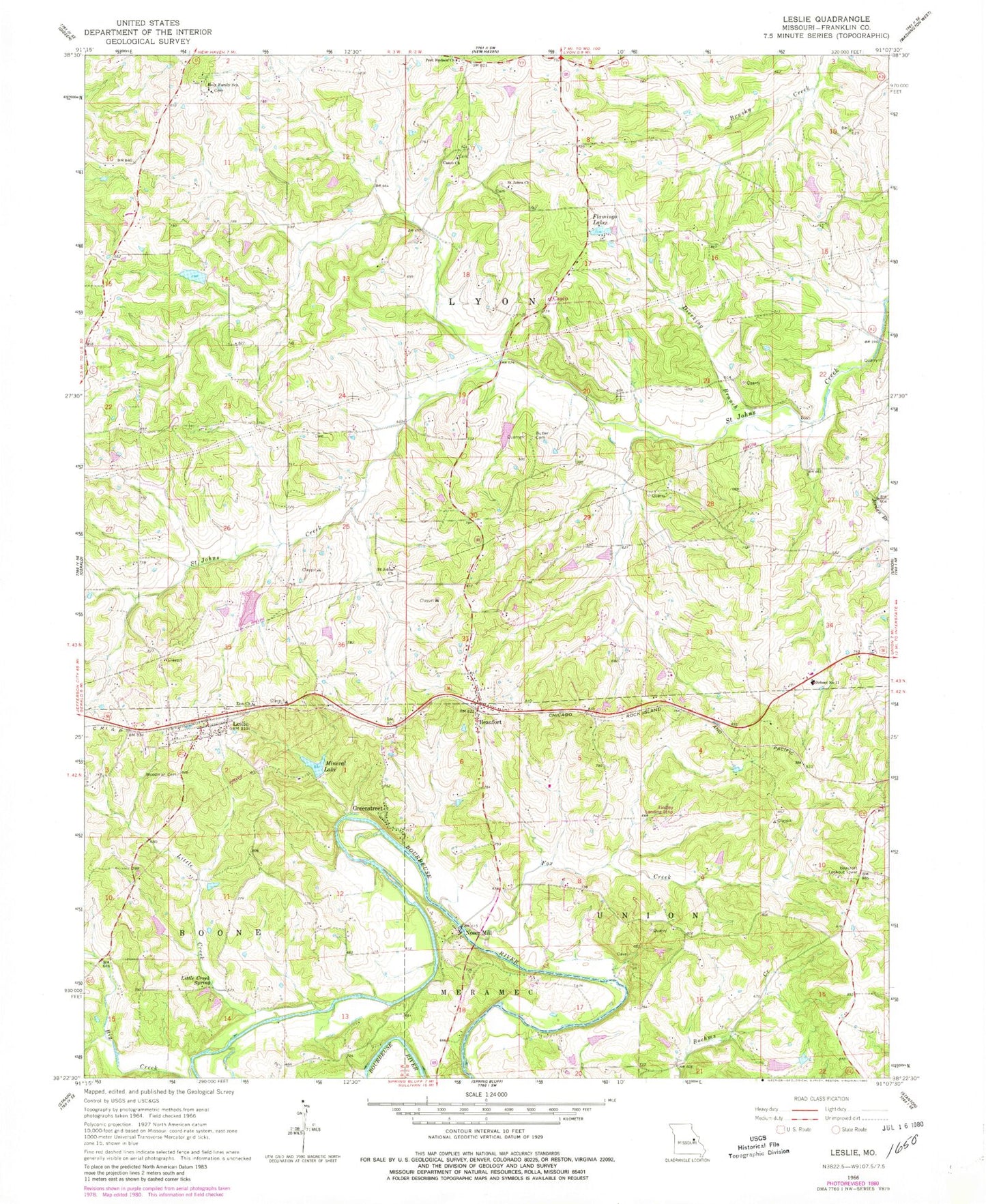
Classic USGS Leslie Missouri 7.5'x7.5' Topo Map
Couldn't load pickup availability
Historical USGS topographic quad map of Leslie in the state of Missouri. Map scale may vary for some years, but is generally around 1:24,000. Print size is approximately 24" x 27"
This quadrangle is in the following counties: Franklin.
The map contains contour lines, roads, rivers, towns, and lakes. Printed on high-quality waterproof paper with UV fade-resistant inks, and shipped rolled.
Contains the following named places: Adams School, Anglers Lake Dam, Beaufort, Beaufort - Leslie Fire Protection District Station 1, Beaufort - Leslie Fire Protection District Station 2, Beaufort Lookout Tower, Beaufort Post Office, Butler Cemetery, Casco, Casco Church, Clover Bottom Fish Farm Lake Dam, Crazy Fox Farm Lake Dam, Dierking Branch, Findley Field, Flamingo Lakes, Fox Creek, Greenstreet, Holy Family School, Janssen Lake Dam, Leslie, Leslie Post Office, Leslie United Methodist Cemetery, Liberty School, Little Creek, Little Creek Ford, Little Creek School, Little Creek Spring, Lucky Nugget Lake Dam, McGinnis Lake Dam, Mineral Lake, Mineral Lake Dam, Netties Greenhouse Lake Dam, Noser Mill, Old Beaufort School, Pleasant Hill School, Port Hudson Church, Port Hudson Holy Family Church, Port Hudson Lutheran School, Saint Johns Church, School Number 11, Sipe Lake Dam, South Beaufort School, Sunnys Field, Township of Lyon, Village of Leslie, Woodman Cemetery, Zion Church, ZIP Codes: 63013, 63056