MyTopo
Classic USGS Lesterville SE Missouri 7.5'x7.5' Topo Map
Couldn't load pickup availability
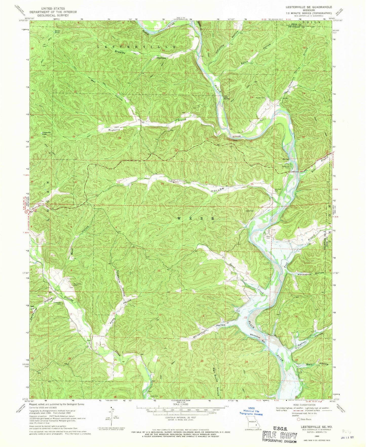
Historical USGS topographic quad map of Lesterville SE in the state of Missouri. Typical map scale is 1:24,000, but may vary for certain years, if available. Print size: 24" x 27"
This quadrangle is in the following counties: Iron, Reynolds.
The map contains contour lines, roads, rivers, towns, and lakes. Printed on high-quality waterproof paper with UV fade-resistant inks, and shipped rolled.
Contains the following named places: Baker Pond, Bear Branch, Bolch Hollow, Boyd Hollow, Brawley Hollow, Carpenter Cemetery, Carpenter Hollow, Cave Spring, Champion Spring Branch, Colyotte Hollow, Dafron Hollow, Funk Branch, Goose Creek, Gulliams Cemetery, Hackworth Hollow, Hampton Cemetery, Leonards Lake, James Wesley Lewis Cemetery, Low Hollow, Mann Cemetery, Mayberry Branch, Pyles Hollow, Pyrtle Hollow, Rutter Cemetery, Sycamore Hollow, Well Hollow, Wet Hollow, Wet Hollow, Whizenhunt Bay, Whizenhunt Hollow, Hyatts Creek, Highway K Public Use Area, Funk Branch Wilderness Camping Site, Martha (historical), Raucom School (historical), Mayberry School, Shed School (historical), Martha Post Office (historical)