MyTopo
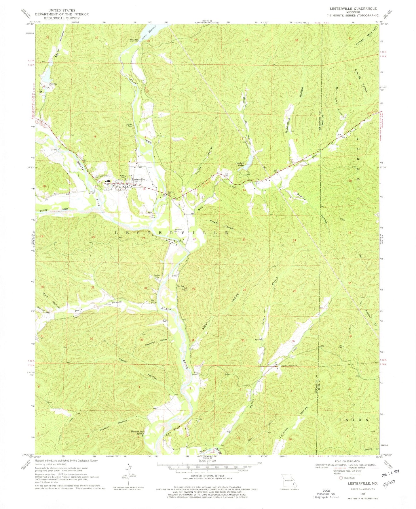
Classic USGS Lesterville Missouri 7.5'x7.5' Topo Map
Couldn't load pickup availability
Historical USGS topographic quad map of Lesterville in the state of Missouri. Map scale may vary for some years, but is generally around 1:24,000. Print size is approximately 24" x 27"
This quadrangle is in the following counties: Iron, Reynolds.
The map contains contour lines, roads, rivers, towns, and lakes. Printed on high-quality waterproof paper with UV fade-resistant inks, and shipped rolled.
Contains the following named places: Adams Hollow, Adkins Hollow, Alcorn Hollow, Clay Lick Hollow, Coaling Hollow, Coil Bluff, Dobbins Cemetery, East Fork Black River, Hyatts Creek Cemetery, Hyatts Creek School, Johnston Mountain, Lake Springs, Lesterville, Lesterville Memorial Cemetery, Lesterville Post Office, Middle Fork Black River, Middleton Hollow, Mill Creek, Mire Lick Creek, Needmore Hollow, Northern Reynolds County Fire Protection District, Okkapassa Dam, Orchard Hollow, Our Lady of Sorrow Church, Peola Branch, Peola School, Pershall Lake Lower, Pershall Lake Upper, Pershall Lakes, Rice Hollow, Sabula Hollow, Scudder Camp, Sela Land Dam, Sherwood Forest Lake, Smith Hollow, Smithboro, Sutton Branch, Taum Sauk Lower Dam, Township of Lesterville, Vickery Mountain, Warner Bay Spring, Warner Hollow, West Fork Black River, Wiggins Ozark Camp Dam, Wright Hollow, ZIP Code: 63654