MyTopo
Classic USGS Letcher NE South Dakota 7.5'x7.5' Topo Map
Regular price
$16.95
Regular price
Sale price
$16.95
Unit price
per
Couldn't load pickup availability
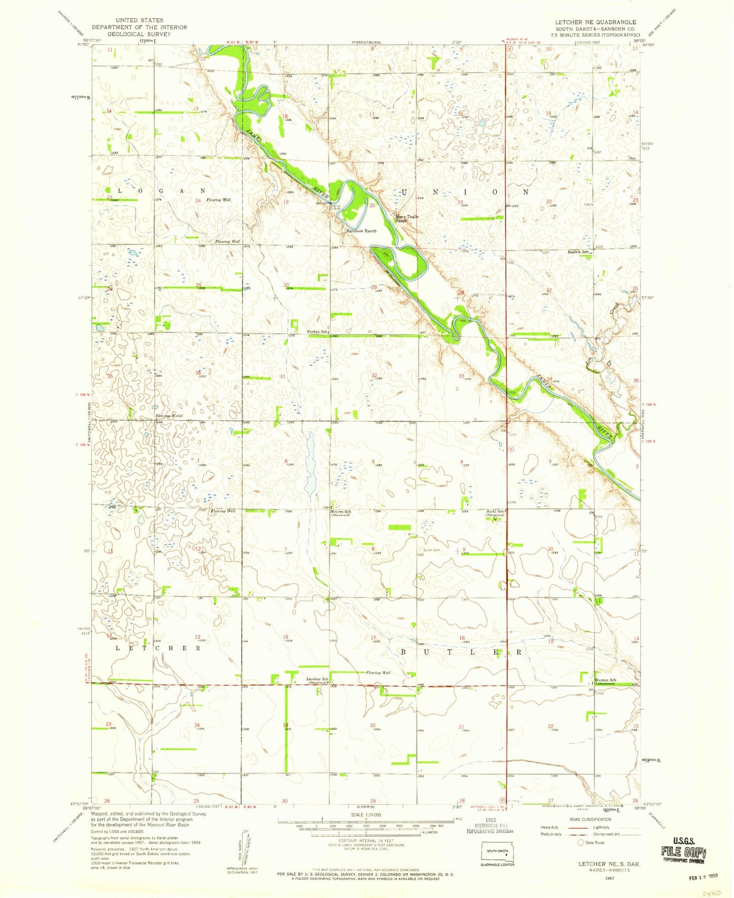
Historical USGS topographic quad map of Letcher NE in the state of South Dakota. Map scale may vary for some years, but is generally around 1:24,000. Print size is approximately 24" x 27"
This quadrangle is in the following counties: Sanborn.
The map contains contour lines, roads, rivers, towns, and lakes. Printed on high-quality waterproof paper with UV fade-resistant inks, and shipped rolled.
Contains the following named places: Butler Cemetery, Forbes School, Jacobus School, Jim Creek, Many Trails Ranch, Meyers School, MJ Aviation I Airport, Rainbow Ranch, Rankin School, Rodee Ford, Stekl School, Township of Butler, Township of Union, Weston School