MyTopo
Classic USGS Letitia Oklahoma 7.5'x7.5' Topo Map
Couldn't load pickup availability
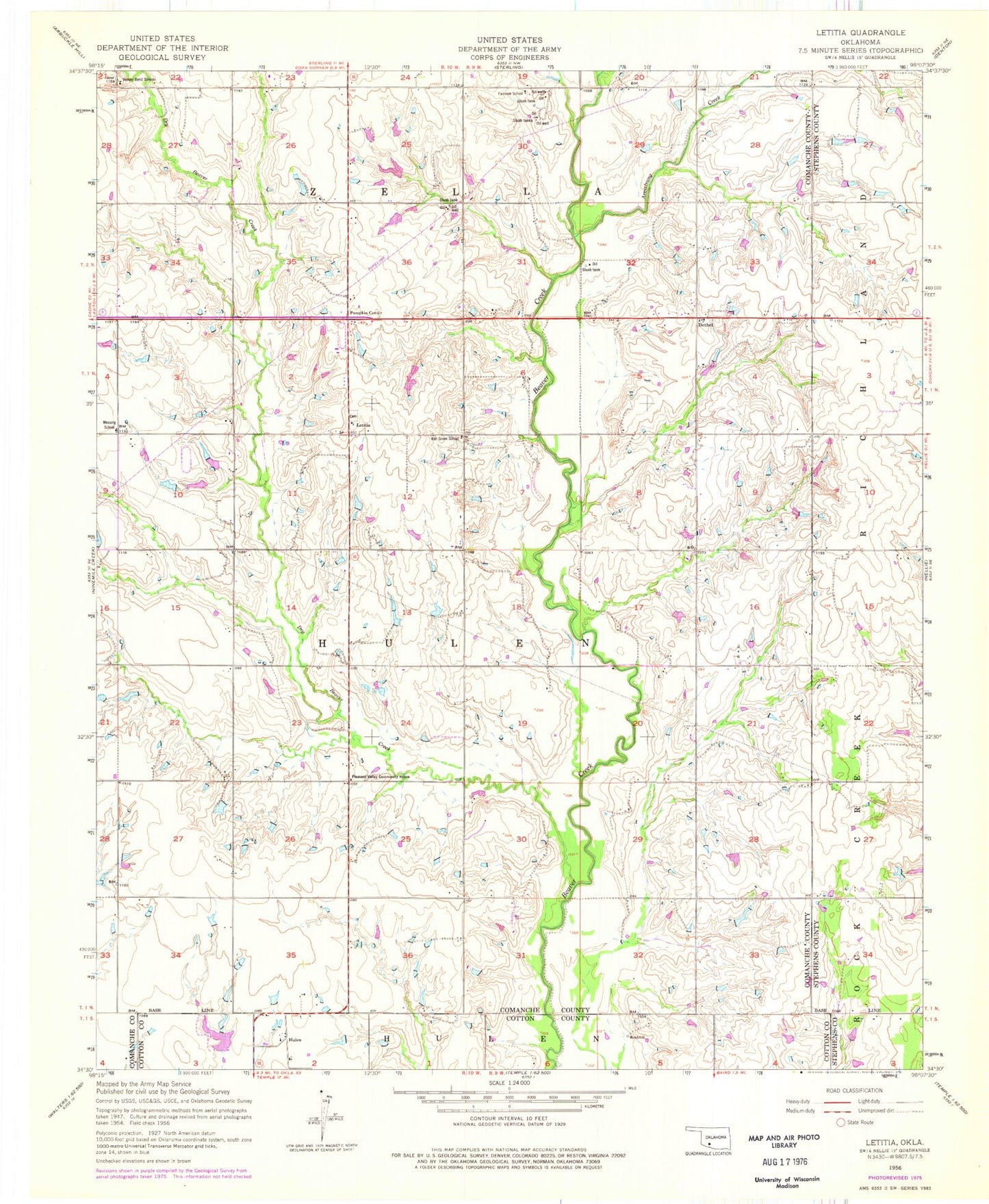
Historical USGS topographic quad map of Letitia in the state of Oklahoma. Map scale may vary for some years, but is generally around 1:24,000. Print size is approximately 24" x 27"
This quadrangle is in the following counties: Comanche, Cotton, Stephens.
The map contains contour lines, roads, rivers, towns, and lakes. Printed on high-quality waterproof paper with UV fade-resistant inks, and shipped rolled.
Contains the following named places: Armstrong Creek, Ash Grove School, Beaver Bend School, Bethel, Bethel Road Volunteer Fire Department, Dry Beaver Creek, Fairview School, Hulen, Hulen Church, Hulen Volunteer Fire Department, KMGZ-FM (Lawton), Letitia, Letitia Community Cemetery, Messing School, Ninemile Beaver Creek, Oknoname 031031 Dam, Oknoname 031031 Reservoir, Oknoname 031032 Dam, Oknoname 031032 Reservoir, Oknoname 031034 Dam, Oknoname 031034 Reservoir, Oknoname 031035 Dam, Oknoname 031035 Reservoir, Oknoname 031055 Reservoir, Oknoname 031056 Dam, Oknoname 031057 Dam, Oknoname 031057 Reservoir, Pleasant Valley Community House, Pumpkin Center, Rock Creek Church, Township of Hulen