MyTopo
Classic USGS Letona Arkansas 7.5'x7.5' Topo Map
Couldn't load pickup availability
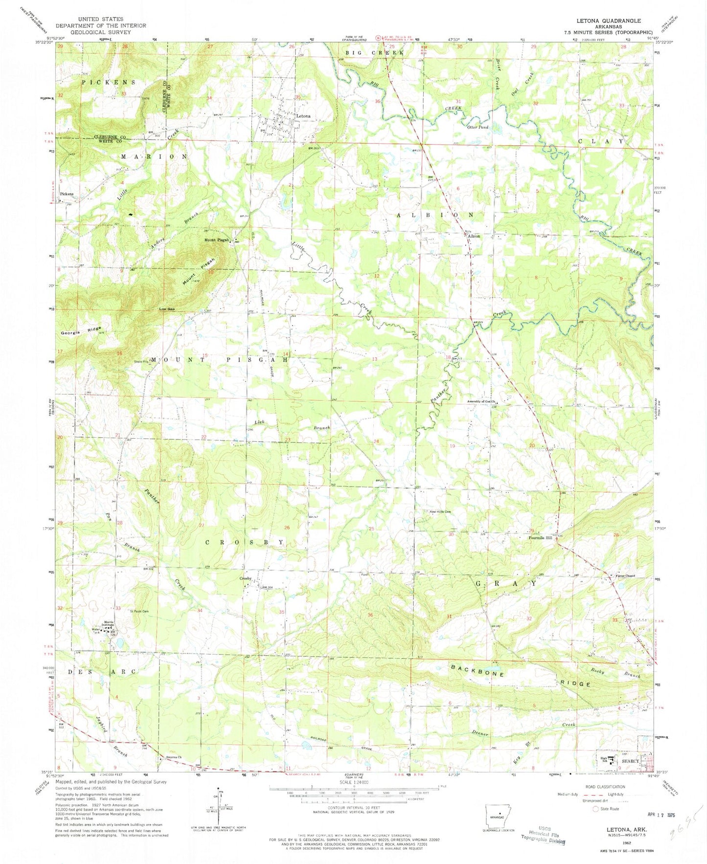
Historical USGS topographic quad map of Letona in the state of Arkansas. Map scale may vary for some years, but is generally around 1:24,000. Print size is approximately 24" x 27"
This quadrangle is in the following counties: Cleburne, White.
The map contains contour lines, roads, rivers, towns, and lakes. Printed on high-quality waterproof paper with UV fade-resistant inks, and shipped rolled.
Contains the following named places: Albion, Albion Volunteer Fire Department, Anders Branch, Assembly of God Church, Backbone Ridge, Brier Creek, Crosby, Crosby Baptist Church, Foster Chapel, Fourmile Hill, Georgia Ridge, Key Branch, Letona, Letona Missionary Baptist Church, Letona Post Office, Letona Volunteer Fire Department, Lick Branch, Little Creek, Low Gap, Morris Institute, Mount Pisgah, New Hope Cemetery, Otter Pond, Owl Creek, Pan Branch, Panther Creek, Pickens, Saint Pauls Cemetery, Searcy High School, Smyrna, Smyrna Church, Town of Letona, Township of Albion, Township of Crosby, Township of Gray, Township of Marion, Township of Mount Pisgah, ZIP Code: 72085