MyTopo
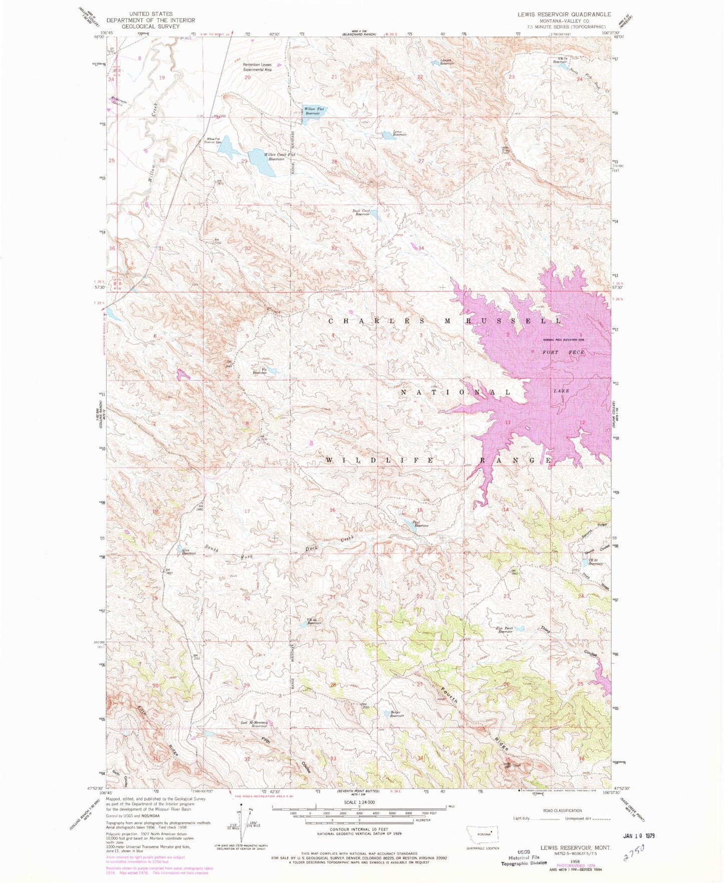
Classic USGS Lewis Reservoir Montana 7.5'x7.5' Topo Map
Couldn't load pickup availability
Historical USGS topographic quad map of Lewis Reservoir in the state of Montana. Map scale may vary for some years, but is generally around 1:24,000. Print size is approximately 24" x 27"
This quadrangle is in the following counties: Valley.
The map contains contour lines, roads, rivers, towns, and lakes. Printed on high-quality waterproof paper with UV fade-resistant inks, and shipped rolled.
Contains the following named places: 25N39E08ACDC01 Well, 26N39E29ADAB01 Well, Berger Reservoir, Bob Number 1 Dam, Duck Creek Reservoir, Five Point Reservoir, Glen Reservoir, Langen Reservoir, Lewis Reservoir, Lost McMenomey Reservoir, Paul Reservoir, Paul Reservoir Dam, Third Coulee, Vic Reservoir, VR 33 Reservoir, VR 44 Reservoir, VR 78 Reservoir, Whatsitsname Dam, Wilderness Coulee, Willow Creek Flat Dam, Willow Creek Flat Reservoir, Willow Flat Diversion Dam, Willow Flat Number 2 Dam, Willow Flat Reservoir, Willow Flat Reservoir Dam