MyTopo
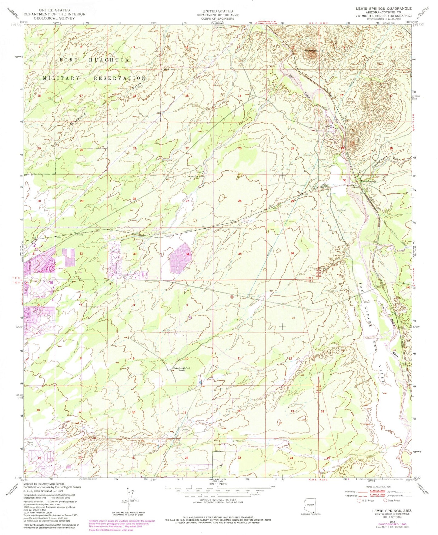
Classic USGS Lewis Springs Arizona 7.5'x7.5' Topo Map
Couldn't load pickup availability
Historical USGS topographic quad map of Lewis Springs in the state of Arizona. Map scale may vary for some years, but is generally around 1:24,000. Print size is approximately 24" x 27"
This quadrangle is in the following counties: Cochise.
The map contains contour lines, roads, rivers, towns, and lakes. Printed on high-quality waterproof paper with UV fade-resistant inks, and shipped rolled.
Contains the following named places: Bakarich-McCool Ranch, Brunckow Hill, Buena High School, Cloud Nine Church of Christ, Cochise College Sierra Vista Campus, Desert Springs Free Will Baptist Church, Donnet-Fry Ranch, Golden Acres Community Church, Government Draw, KKYZ-FM (Sierra Vista), KMFI-AM (Sierra Vista), KSVA-AM (Sierra Vista), Lewis Springs, Mountain View Assembly of God Church, New Hope Fellowship Church, Oasis Foursquare Church, Pueblo Del Sol Elementary School, San Pedro House, San Pedro Riparian National Conservation Area, San Rafael del Valle, University of Arizona South, Vista View Resort Mobile Home Park, ZIP Codes: 85635, 85650