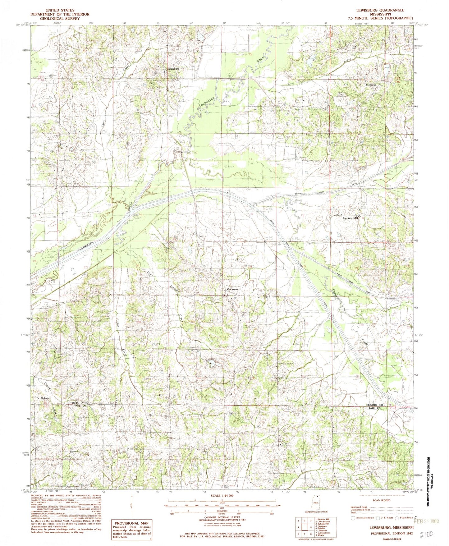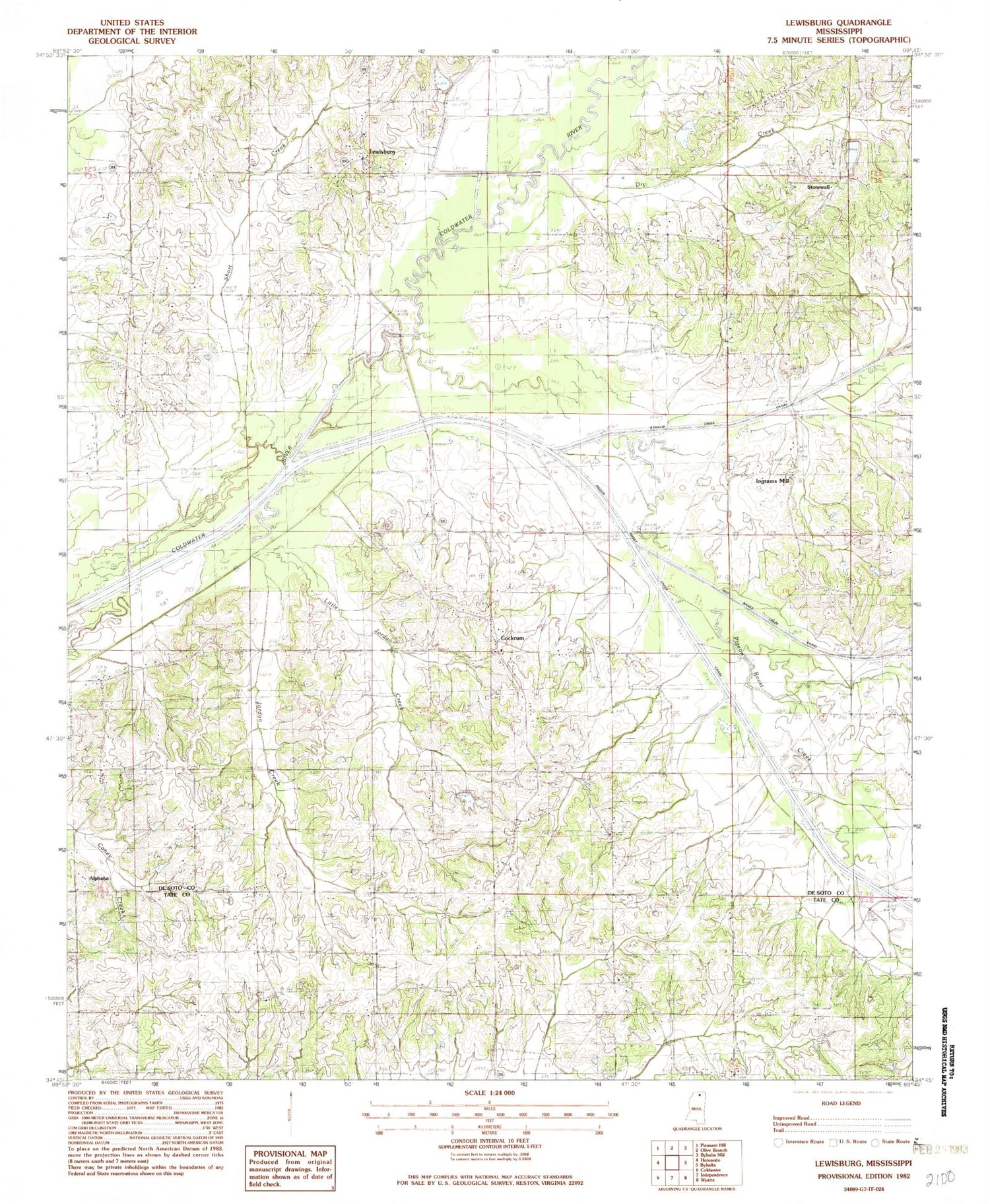
MyTopo
Classic USGS Lewisburg Mississippi 7.5'x7.5' Topo Map
Couldn't load pickup availability
Historical USGS topographic quad map of Lewisburg in the state of Mississippi. Map scale may vary for some years, but is generally around 1:24,000. Print size is approximately 24" x 27"
This quadrangle is in the following counties: DeSoto, Tate.
The map contains contour lines, roads, rivers, towns, and lakes. Printed on high-quality waterproof paper with UV fade-resistant inks, and shipped rolled.
Contains the following named places: Alphaba, Alphaba - Cockrum - Ingrams Mill Volunteer Fire Department Station 1, Alphaba - Cockrum - Ingrams Mill Volunteer Fire Department Station 2, Byhalia Creek, Byhalia Creek Canal, C C Herrington Lake Dam, Center Point Cemetery, Center Point Church, Center Point School, Charles Long Pond Dam, Cockrum, Cockrum School, Drain Family Cemetery, Dry Creek, Fountain Head Cemetery, Fountain Head Church, Greenleaf, Greenleaf Cemetery, Greenleaf Church, Greenleaf Consolidated School, Greenleaf Volunteer Fire Department, Hollaway Bridge, Ingram School, Ingrams Mill, J L Eason Junior Pond Dam, Jordan Creek, Kelly Cemetery, Lewisburg, Lewisburg Fire Department, Little Jordan Creek, M F Harris Pond Dam, Matts Chapel Church, Matts School, Mills Family Cemetery, Mount Austin Cemetery, Mount Austin Church, Mount Mana Church, New Hope Baptist Church, New Hope Church Cemetery, New Prospect Baptist Church, Pentacostal Church, Perry Church Cemetery, Pigeon Roost Creek, Pigeon Roost Creek Canal, Pryor Cemetery, Red Banks Creek Canal, Short Branch, Stonewall, Vaiden Landing, Whites Chapel Cemetery, Whites Chapel Church, Whites Chapel School, Winbourn Cemetery