MyTopo
Classic USGS Lewiston Michigan 7.5'x7.5' Topo Map
Couldn't load pickup availability
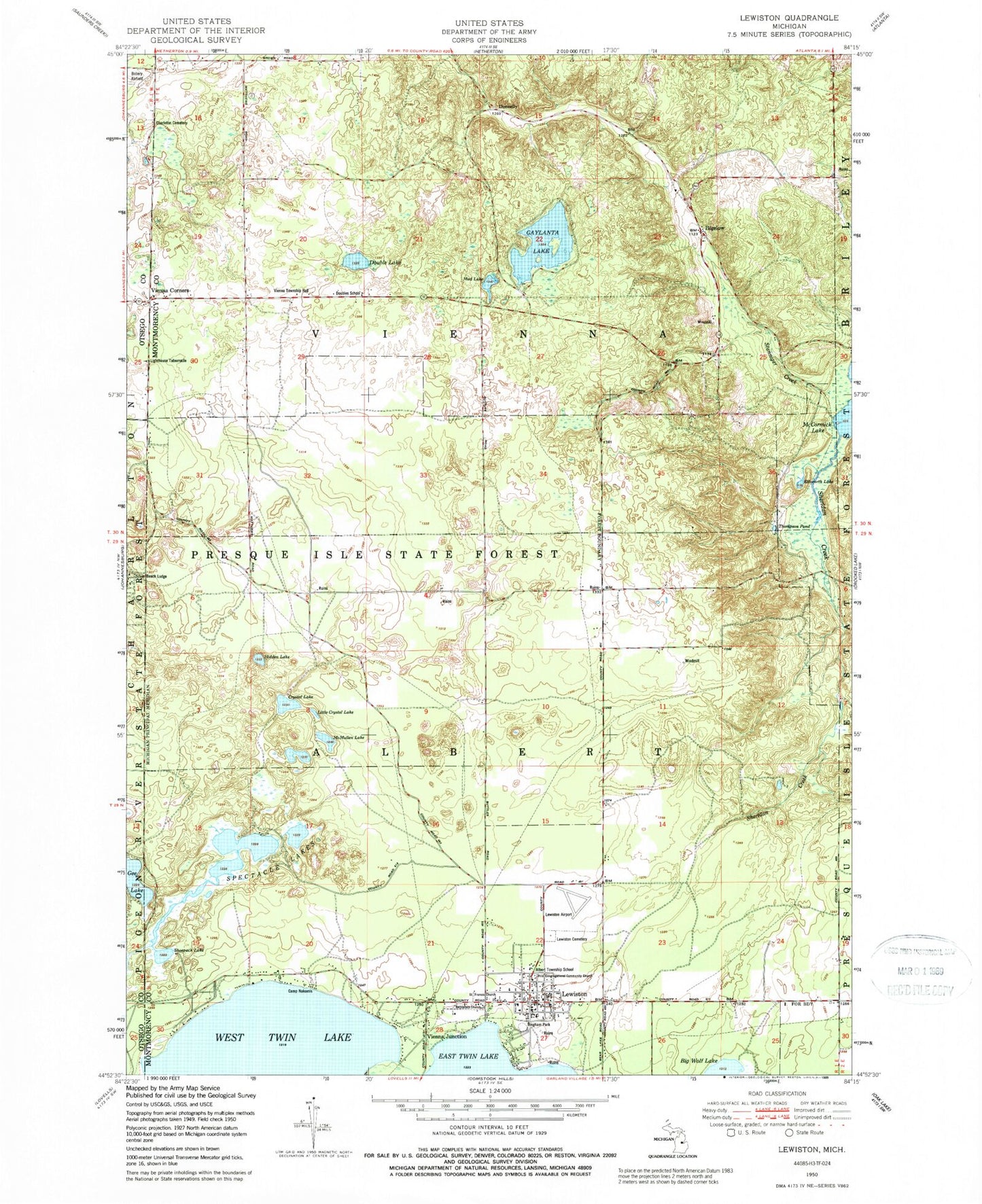
Historical USGS topographic quad map of Lewiston in the state of Michigan. Map scale may vary for some years, but is generally around 1:24,000. Print size is approximately 24" x 27"
This quadrangle is in the following counties: Montmorency, Otsego.
The map contains contour lines, roads, rivers, towns, and lakes. Printed on high-quality waterproof paper with UV fade-resistant inks, and shipped rolled.
Contains the following named places: Albert Township Hall, Albert Township School, Angusdale Stock Farm Historical Marker, Bethlehem Church, Bigelow, Bingham Park, Bourne Lake, Camp Nakomis, Charleton Cemetery, Congregational United Church of Christ Historical Marker, Crystal Lake, Donnelly, Double Lake, Doubles School, Ellsworth Lake, First Baptist Church, First Congregational Community Church, Gaylanta Lake, Gee Lake, Hidden Lake, Idlewild Post Office, Kirtland Lake, Lewiston, Lewiston Cemetery, Lewiston Census Designated Place, Lewiston Fire Department, Lewiston Post Office, Lewiston Public Library, Lewiston Station, Lighthouse Tabernacle, Little Crystal Lake, Lunden Lake, McCormick Lake Campground, McMullen Lake, Presque Isle State Forest, Saint Francis Church, Saint Francis of Assisi Catholic Cemetery, Sheridan Creek, Shoepack Lake, Silver Beach Lodge, Spectacle Lake, Spectacle Lakes, Stanniger Creek, Thompson Pond, Township of Albert, Twin Lakes Airport, Vienna Corners, Vienna Junction, Vienna Junction Station, Vienna Post Office, Vienna Township Fire Department, Vienna Township Hall, West Twin Lake, Woodmere Lake


