MyTopo
Classic USGS Lewistown Missouri 7.5'x7.5' Topo Map
Couldn't load pickup availability
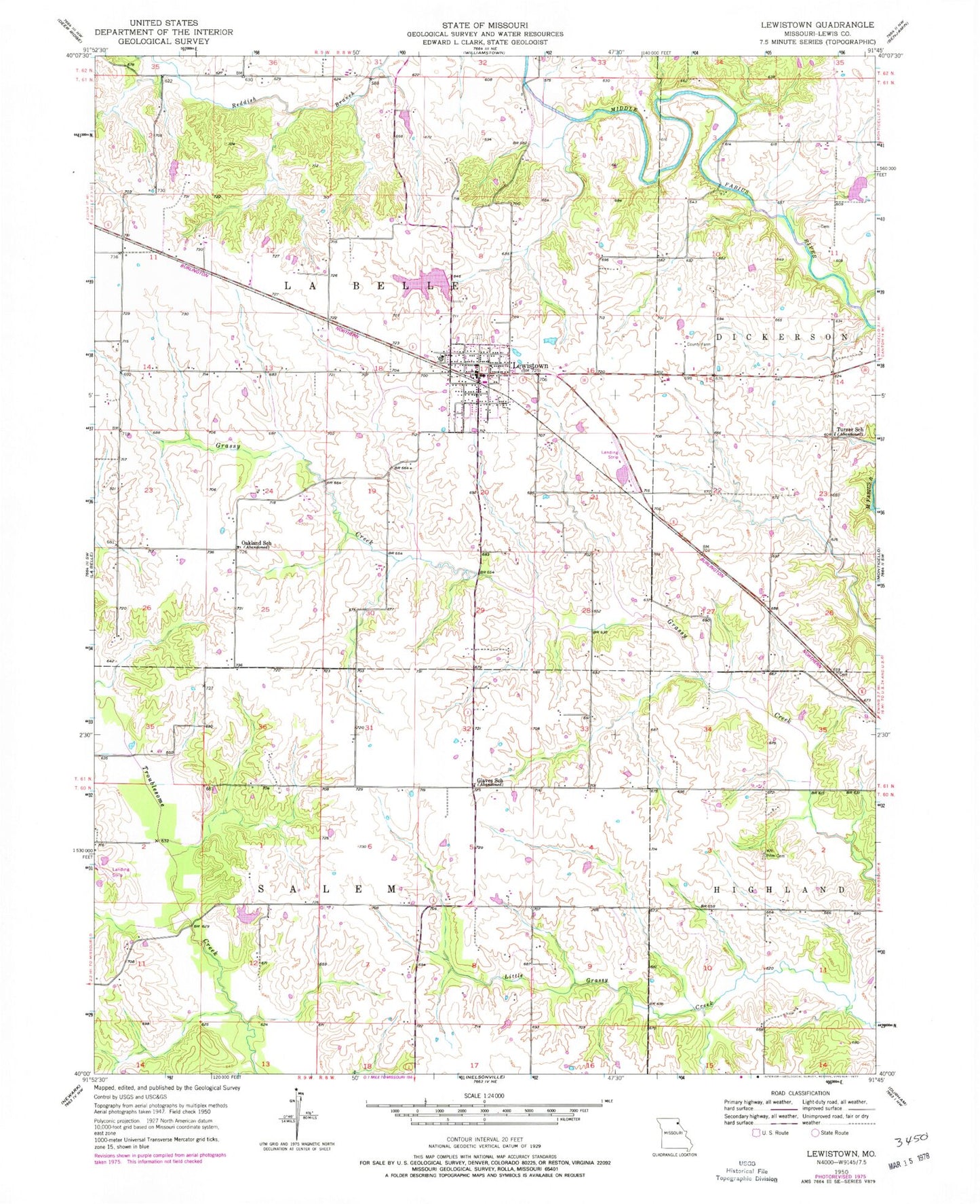
Historical USGS topographic quad map of Lewistown in the state of Missouri. Map scale may vary for some years, but is generally around 1:24,000. Print size is approximately 24" x 27"
This quadrangle is in the following counties: Lewis.
The map contains contour lines, roads, rivers, towns, and lakes. Printed on high-quality waterproof paper with UV fade-resistant inks, and shipped rolled.
Contains the following named places: Baker Dam, Baker Lake, Blair Branch, City of Lewistown Dam, City of Lewistown Reservoir, Geisendorfer Lake, Geisendorfer Lake Dam, Glaves School, Jerusalem, Lewistown, Lewistown Post Office, Lewistown Volunteer Fire Department, Luttrell Farms Dam, Luttrell Farms Lake, New Court Village, Oakland School, Phillips Airport, Prim Cemetery, Sharpe Lake, Sharpe Lake Dam, Town of Lewistown, Township of La Belle, Turner School, ZIP Code: 63452