MyTopo
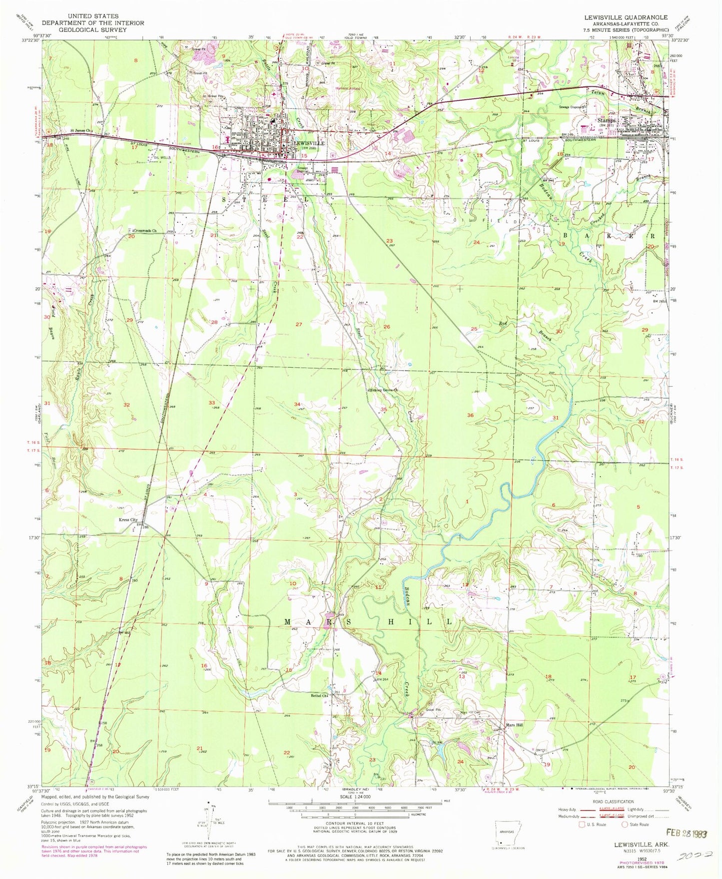
Classic USGS Lewisville Arkansas 7.5'x7.5' Topo Map
Couldn't load pickup availability
Historical USGS topographic quad map of Lewisville in the state of Arkansas. Map scale may vary for some years, but is generally around 1:24,000. Print size is approximately 24" x 27"
This quadrangle is in the following counties: Lafayette.
The map contains contour lines, roads, rivers, towns, and lakes. Printed on high-quality waterproof paper with UV fade-resistant inks, and shipped rolled.
Contains the following named places: Battle Creek, Bethel Church, City of Lewisville, Crooked Branch, Crossroads Church, Hickory Grove Church, Kress City, Lafayette County Ambulance Service, Lafayette County Middle School, Lafayette County Sheriff's Office, Lafayette County West Elementary School, Lewisville, Lewisville High School, Lewisville Middle School, Lewisville Oil and Gas Field, Lewisville Police Department, Lewisville Post Office, Lewisville Volunteer Fire Station, Mars Hill, Mars Hill Cemetery, Mars Hill Oil and Gas Field, Mars Hill Volunteer Fire Department, Rawls Creek, Red Branch, Saint James Church, Steel Creek, Tatum Branch, Township of Mars Hill