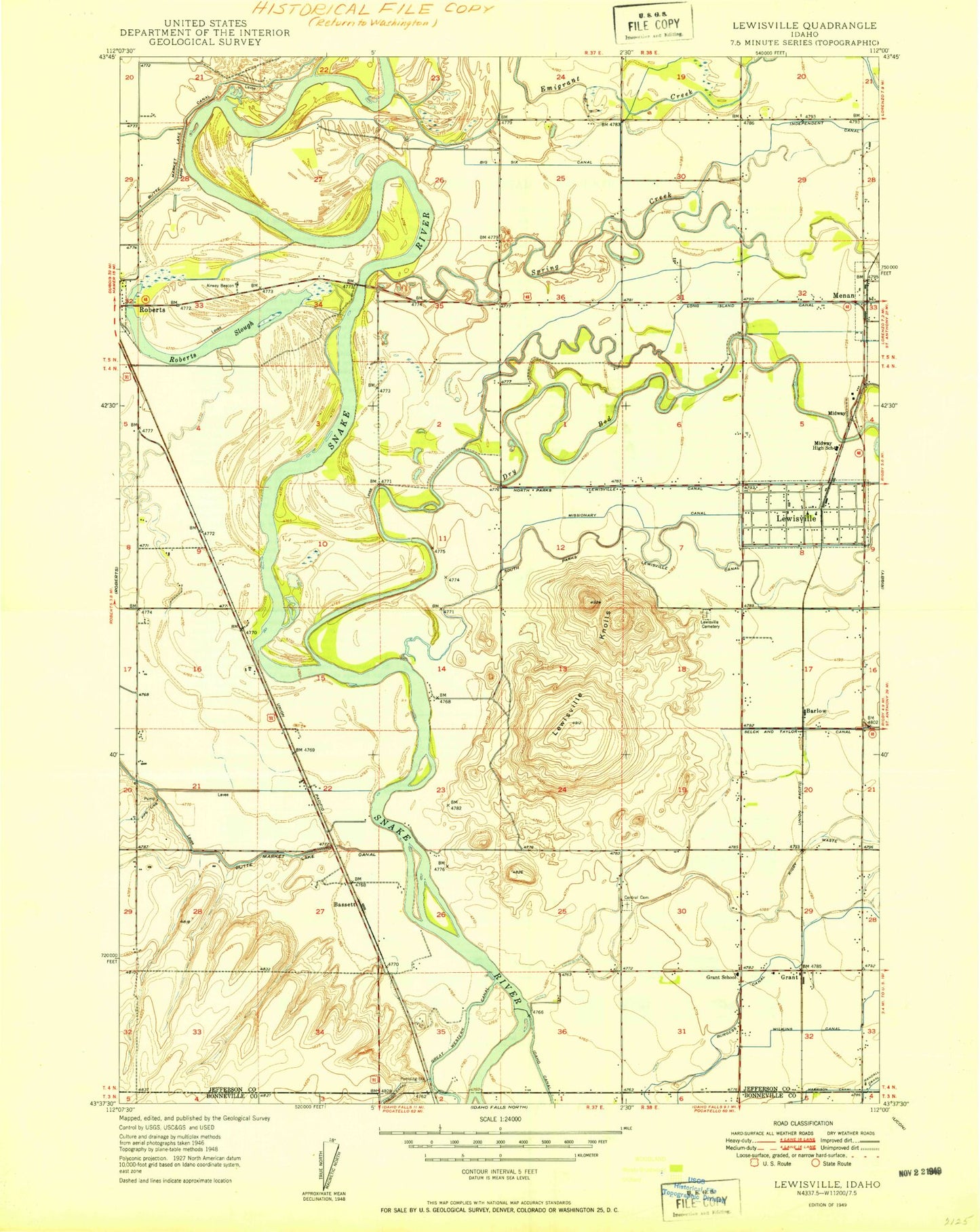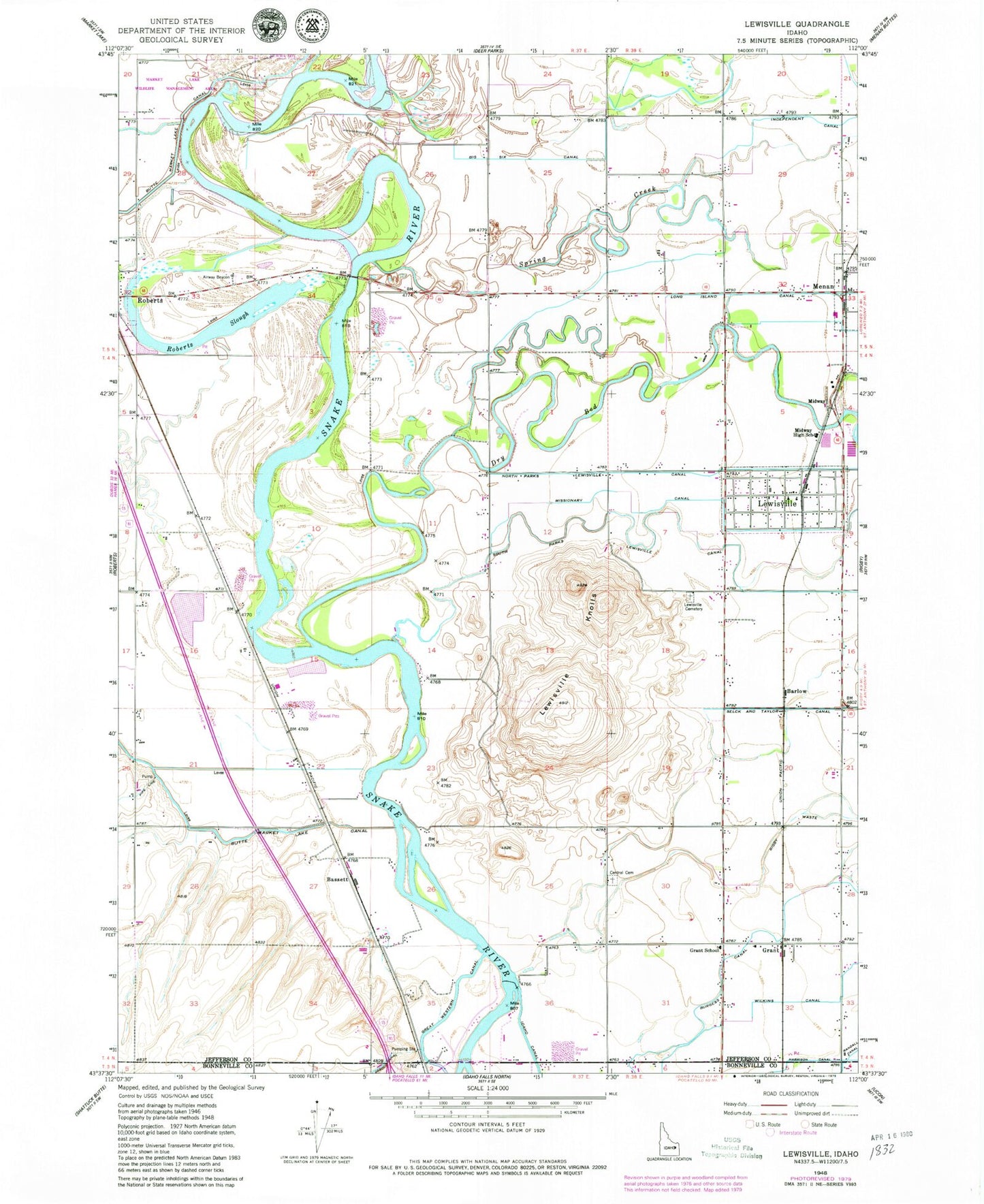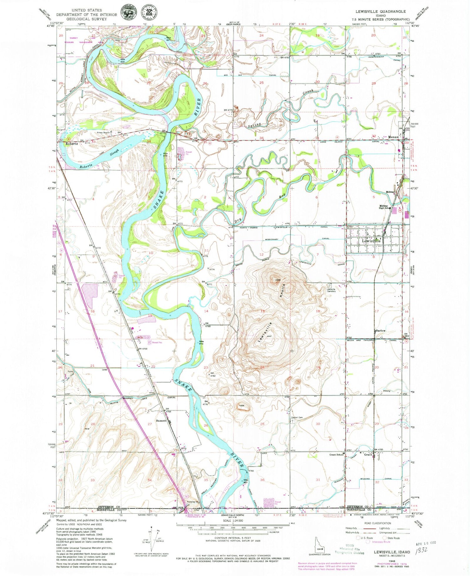
MyTopo
Classic USGS Lewisville Idaho 7.5'x7.5' Topo Map
Couldn't load pickup availability
Historical USGS topographic quad map of Lewisville in the state of Idaho. Map scale may vary for some years, but is generally around 1:24,000. Print size is approximately 24" x 27"
This quadrangle is in the following counties: Bonneville, Jefferson.
The map contains contour lines, roads, rivers, towns, and lakes. Printed on high-quality waterproof paper with UV fade-resistant inks, and shipped rolled.
Contains the following named places: Barlow, Bassett, Big Six Canal, Butte Market Lake Canal, Central Cemetery, Central Fire District Station 3, City of Lewisville, Deer Park Canal, Dry Bed, Emigrant Creek, Grant, Grant School, Idaho Diversion Dam, Independent Canal, Lewisville, Lewisville Cemetery, Lewisville Knolls, Lewisville Post Office, Lewisville-Menan Division, Menan Post Office, Midway, Midway Elementary School, Midway High School, Midway Middle School, Missionary Canal, Roberts Slough, Spring Creek, Wilkins Canal, ZIP Code: 83431