MyTopo
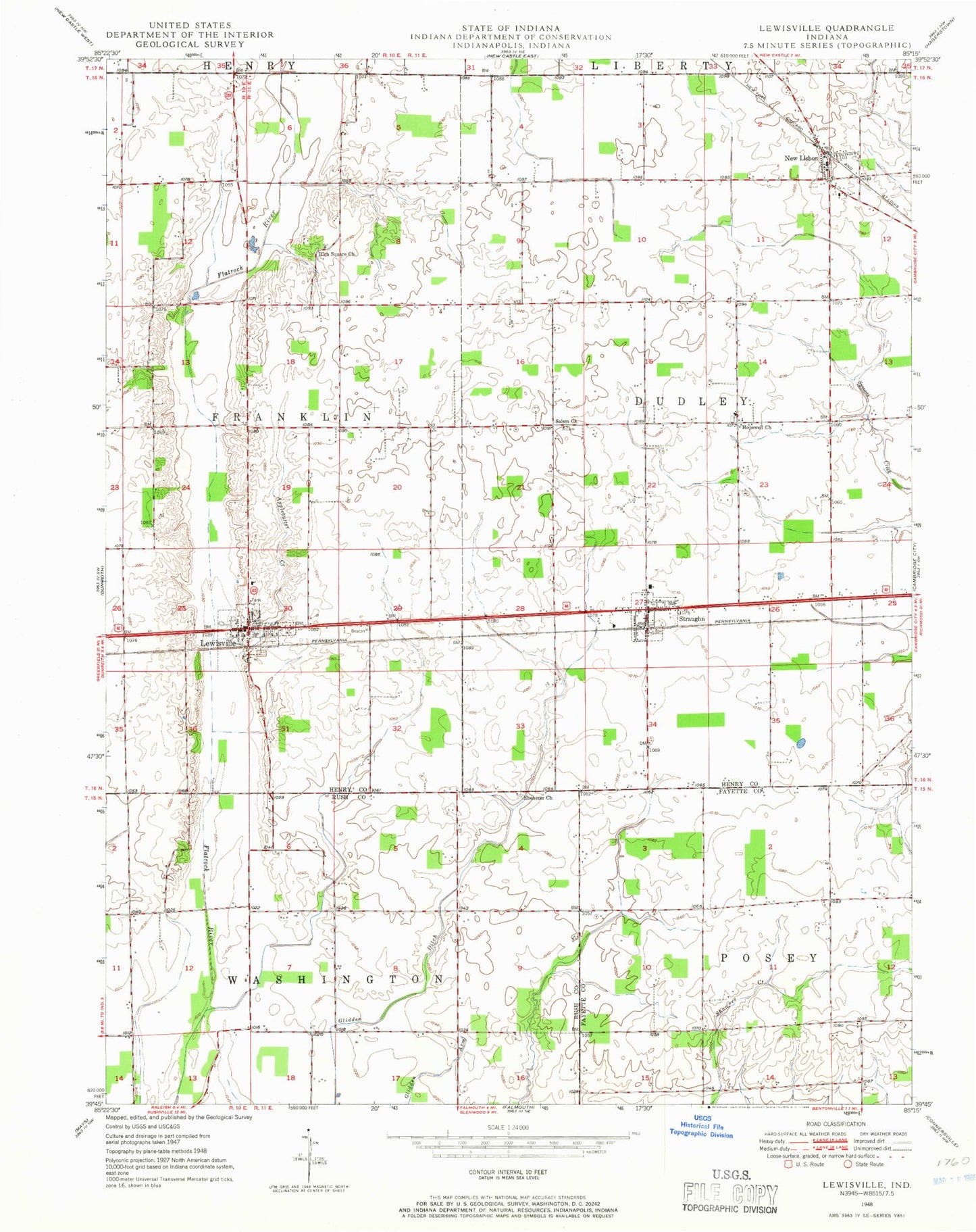
Classic USGS Lewisville Indiana 7.5'x7.5' Topo Map
Couldn't load pickup availability
Historical USGS topographic quad map of Lewisville in the state of Indiana. Map scale may vary for some years, but is generally around 1:24,000. Print size is approximately 24" x 27"
This quadrangle is in the following counties: Fayette, Henry, Rush.
The map contains contour lines, roads, rivers, towns, and lakes. Printed on high-quality waterproof paper with UV fade-resistant inks, and shipped rolled.
Contains the following named places: Applebutter Creek, Brittanham Cemetery, Ebenezer Cemetery, Ebenezer Church, Hall Ditch, Hopewell Church, Lewisville, Lewisville Post Office, Lewisville Volunteer Fire Department, New Castle-Henry County Municipal Airport, New Lisbon, New Lisbon Community Volunteer Fire Department, New Lisbon Post Office, Rich Square Church, Salem Church, Shanee Bluff Cemetery, Straughn, Straughn Post Office, Straughn Volunteer Fire Department, Town of Lewisville, Town of Straughn, Township of Dudley, Township of Franklin, Tri Junior-Senior High School, ZIP Codes: 47352, 47387