MyTopo
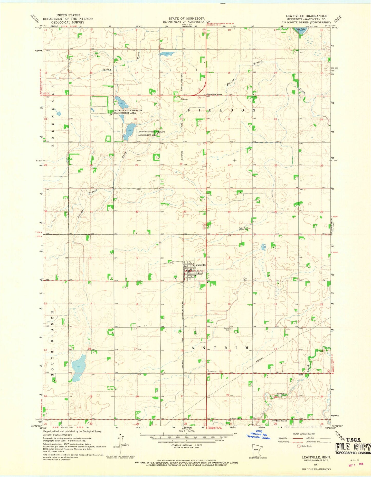
Classic USGS Lewisville Minnesota 7.5'x7.5' Topo Map
Couldn't load pickup availability
Historical USGS topographic quad map of Lewisville in the state of Minnesota. Map scale may vary for some years, but is generally around 1:24,000. Print size is approximately 24" x 27"
This quadrangle is in the following counties: Watonwan.
The map contains contour lines, roads, rivers, towns, and lakes. Printed on high-quality waterproof paper with UV fade-resistant inks, and shipped rolled.
Contains the following named places: Antrim Cemetery, City of Lewisville, KEEZ-FM (Mankato), KEYC-TV (Mankato), Lewisville, Lewisville Fire Department, Lewisville Library, Lewisville Police Department, Lewisville Post Office, Lewisville State Wildlife Management Area, Lone Star School, Madelia State Wildlife Management Area, Saint John's Lutheran Church, Saint Johns School, Sieg's Farm Airport, Tenmile Corner, Township of Antrim, Township of Fieldon, Zion Cemetery, Zion Lutheran Church, ZIP Code: 56060