MyTopo
Classic USGS Lexa Arkansas 7.5'x7.5' Topo Map
Couldn't load pickup availability
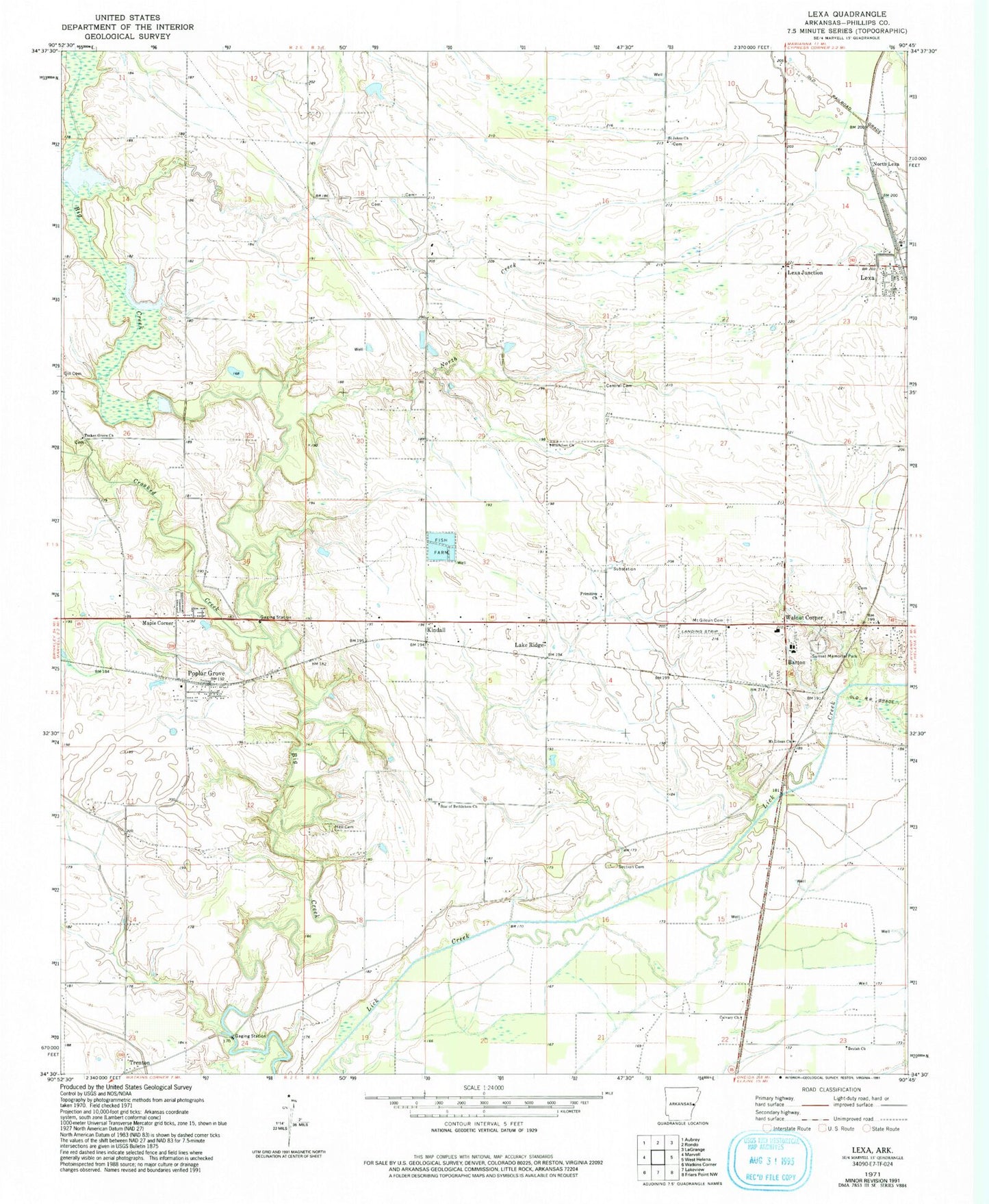
Historical USGS topographic quad map of Lexa in the state of Arkansas. Map scale may vary for some years, but is generally around 1:24,000. Print size is approximately 24" x 27"
This quadrangle is in the following counties: Phillips.
The map contains contour lines, roads, rivers, towns, and lakes. Printed on high-quality waterproof paper with UV fade-resistant inks, and shipped rolled.
Contains the following named places: Barton, Barton - Lexa Elementary School, Barton - Lexa High School, Barton Baptist Church, Barton Post Office, Barton Rural Fire Station, Beulah Church, Blackfoot, Blackfoot Church, Calvary Church, Central Cemetery, Crooked Creek, Harbis, Hell Cemetery, Kindall, Lake Ridge, Lexa, Lexa Junction, Lexa Rural Volunteer Fire Department, Maple Corner, Moores Chapel, Mount Gilean Cemetery, Mount Gilean Church, North Creek, North Lexa, Poplar Grove, Poplar Grove Census Designated Place, Poplar Grove Post Office, Primitive Church, Saint James Cemetery, Saint Johns Cemetery, Saint Johns Church, Saint Peters Church, Section Cemetery, Star of Bethlehem Church, Sunset Memorial Park, Town of Lexa, Township of Marion, Township of Spring Creek, Tucker Grove Cemetery, Tucker Grove Church, Walnut Corner, ZIP Code: 72374