MyTopo
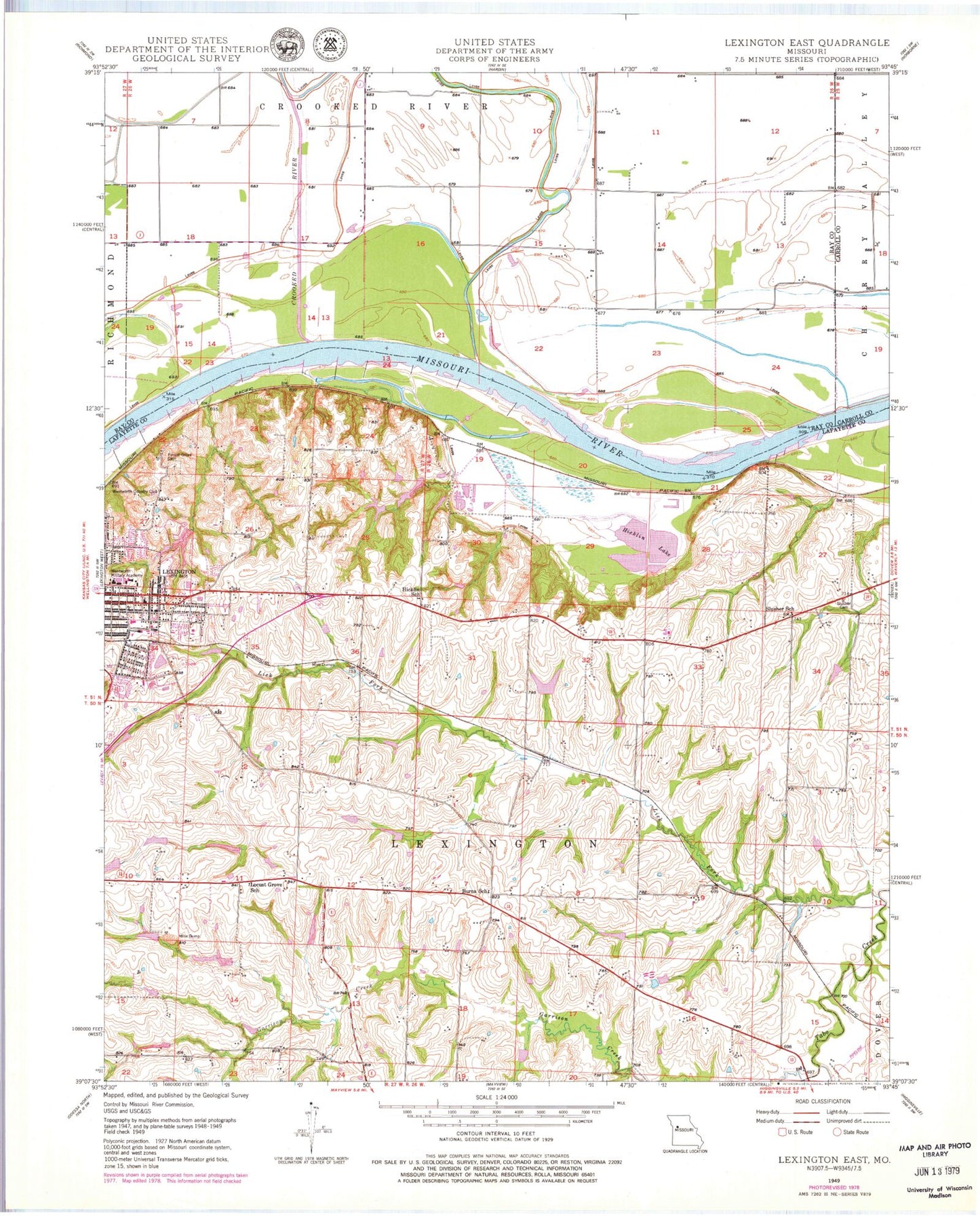
Classic USGS Lexington East Missouri 7.5'x7.5' Topo Map
Couldn't load pickup availability
Historical USGS topographic quad map of Lexington East in the state of Missouri. Map scale may vary for some years, but is generally around 1:24,000. Print size is approximately 24" x 27"
This quadrangle is in the following counties: Carroll, Lafayette, Ray.
The map contains contour lines, roads, rivers, towns, and lakes. Printed on high-quality waterproof paper with UV fade-resistant inks, and shipped rolled.
Contains the following named places: Burns School, Carter Lake Section 10 Lower Dam, Carter Lake Section 10 Upper Dam, Carter Lake Section 11 Dam, Carter Lake Section 25 Lower Dam, Carter Lake Section 25 Upper Dam, City of Lexington, Crooked River, Crystal Lakes Dam, Dickmeyer Lake, Forest Grove Cemetery, Garrison Creek, Halls, Hicklin Lake, Hicklin School, KCAC-FM (Lexington), KLEX-AM (Lexington), Ladys Lake Dam, Lafayette D10 Lake, Leslie Bell Elementary School, Lex La - Ray Technical Center, Lexington Bend, Lexington City Park Dam, Lexington High School, Lexington Middle School, Lexington Police Department, Lick Fork, Lions Club Lake Number 10298, Locust Grove School, Long Branch, Mallory School, Northrup, Number 140 Reservoir, Number 141 Reservoir, Number 143 Reservoir, Number 185 Reservoir, Oak Grove School, Palmer Sill Lake, Petsch Dam, Prairie Valley School, Sam Smiths Lake, Sauk Prairie, Sheep Nose Bend, Slusher Cemetery, Slusher School, Starke Lake Dam, Tabo Bend, Tabo Creek Watershed Structure A-22 Dam, Tabo Creek Watershed Structure C-25 Dam, Tabo Creek Watershed Structure C-27 Dam, Tabo Creek Watershed Structure C-28 Dam, Tabo Creek Watershed Structure C-29 Dam, Tabo Creek Watershed Structure C-33 Dam, Tabo Creek Watershed Structure D-20 Dam, Tabo Creek Watershed Structure D-23 Dam, Tabo Creek Watershed Structure D-24 Dam, Tabo Creek Watershed Structure D-26 Dam, Tabo Creek Watershed Structure D-28 Dam, Tabo Creek Watershed Structure D-29 Dam, Tabo Creek Watershed Structure D-30 Dam, Township of Lexington, Wentworth Country Club, Wentworth Military Academy, Winton, ZIP Code: 64067