MyTopo
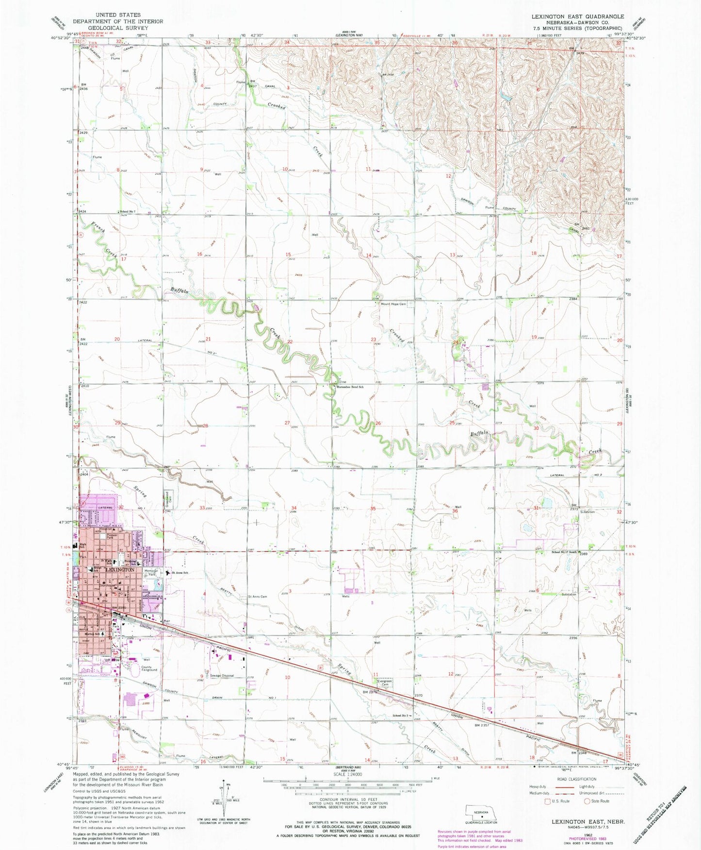
Classic USGS Lexington East Nebraska 7.5'x7.5' Topo Map
Couldn't load pickup availability
Historical USGS topographic quad map of Lexington East in the state of Nebraska. Map scale may vary for some years, but is generally around 1:24,000. Print size is approximately 24" x 27"
This quadrangle is in the following counties: Dawson.
The map contains contour lines, roads, rivers, towns, and lakes. Printed on high-quality waterproof paper with UV fade-resistant inks, and shipped rolled.
Contains the following named places: Arbor Park, Berean Fundamental Church, Berquist Lateral, Bryan School, Calvary Assembly of God Church, Church of Christ, City of Lexington, Crooked Creek, Dawson County Courthouse, Dawson County Fairgrounds, Dawson County Historical Museum, Dawson County Sheriff's Office, DeBruce Grain Incorporated Elevator, Donald Price Mobile Home Park, Evangelical Free Church, Evergreen Cemetery, First Baptist Church, First Presbyterian Church, First United Methodist Church, French Creek, Gable View Inn Campground, Grace Lutheran Church, Grant Election Precinct, Greenwood Cemetery, Lateral Number 2, Lexington, Lexington High School, Lexington Middle School, Lexington Police Department, Lexington Post Office, Lexington Public Library, Lexington Volunteer Fire Department, Memorial Park, Morton School, Mount Hope Cemetery, Northside Church of Christ, Oak Park, Pershing School, Pioneer Park, Plum Creek Care Center, Plum Creek Memorial Wall, Prairie View Estates, Saint Anns Catholic Church, Saint Anns Cemetery, Saint Anns School, Saint Peters Episcopal Church, School Number 17 North, School Number 17 South, School Number 3, School Number 56, School Number 7, Sherman Dam, Sherman Reservoir, Trinity Lutheran Church, Womans Health Services, ZIP Code: 68850