MyTopo
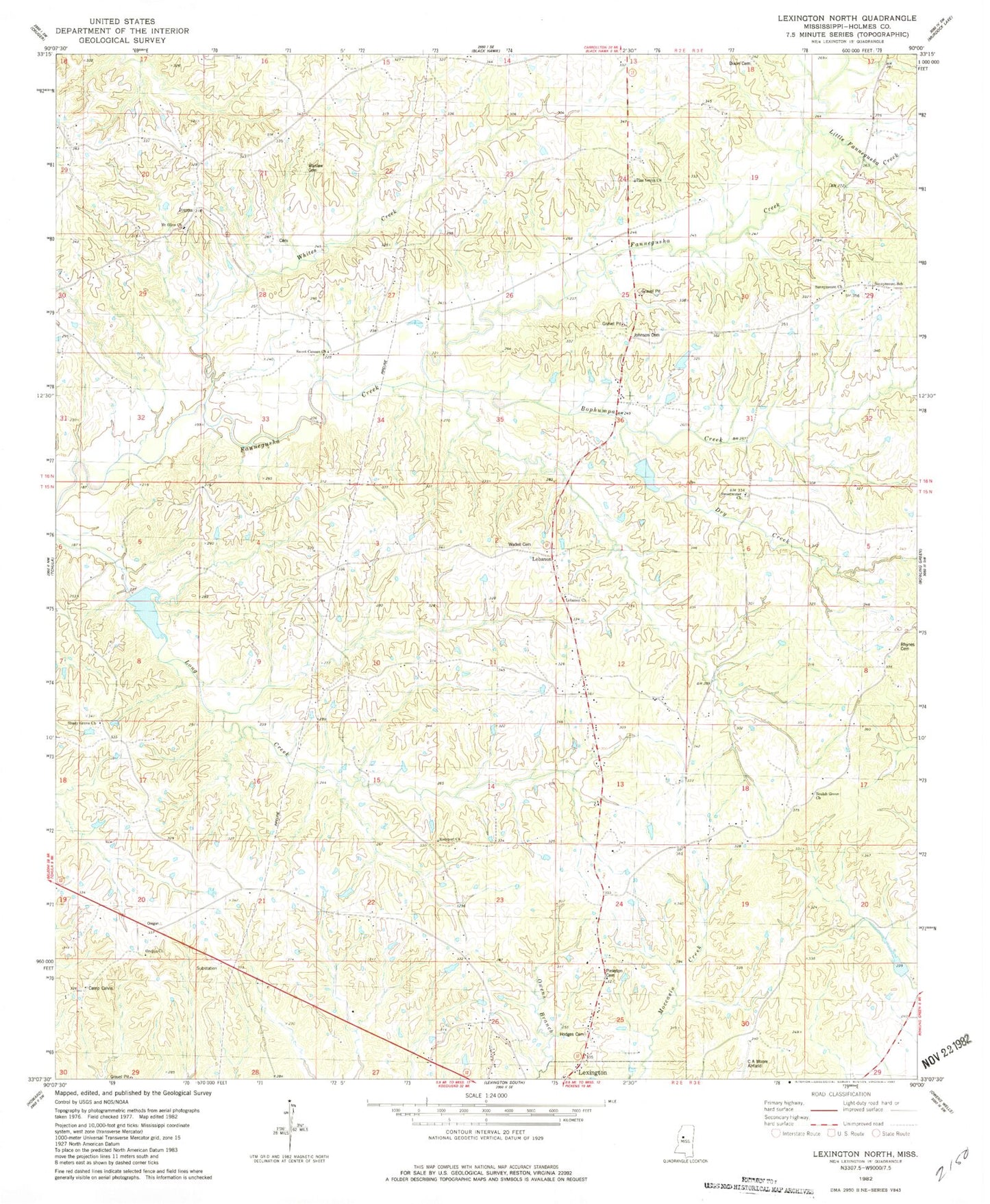
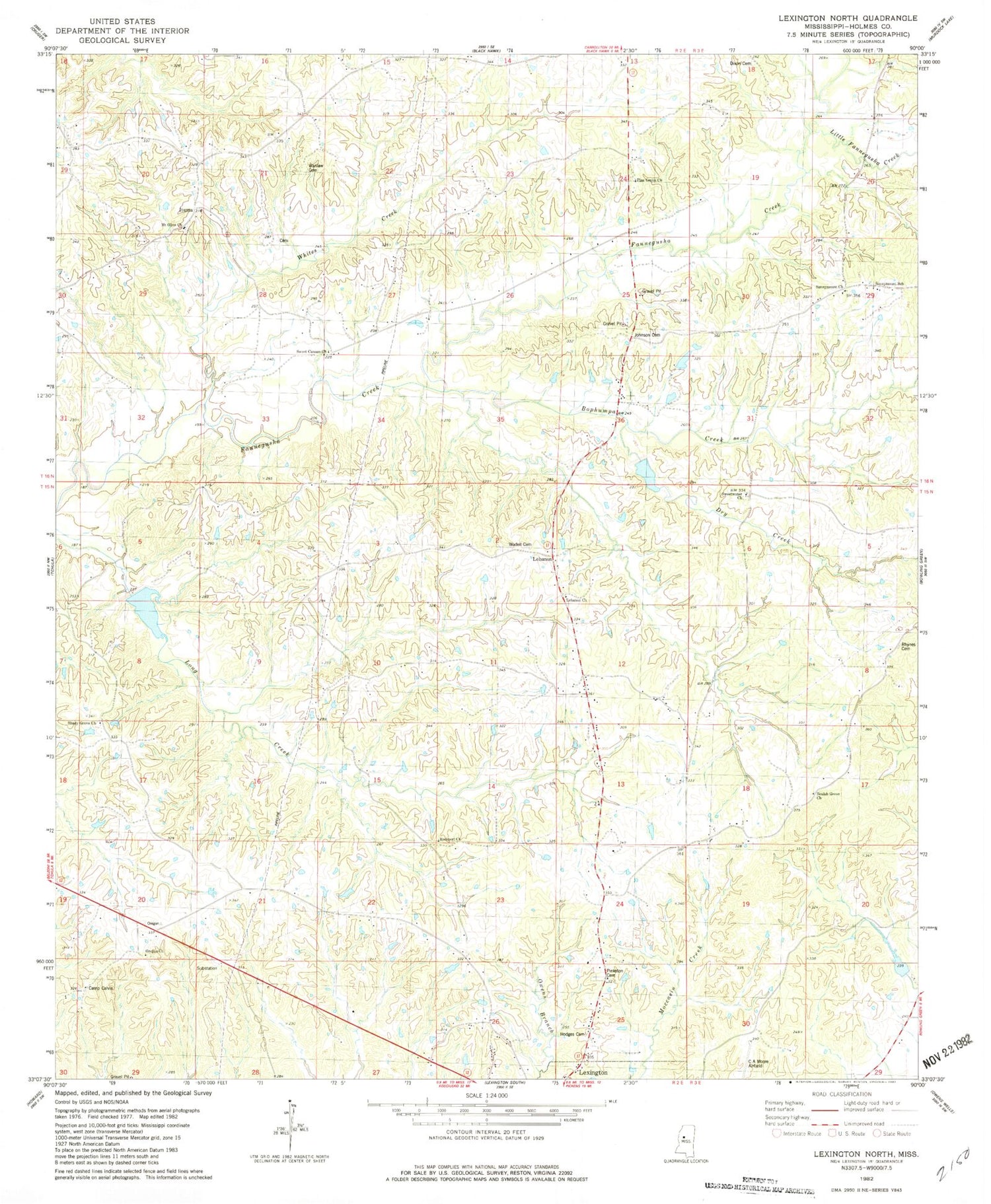
Classic USGS Lexington North Mississippi 7.5'x7.5' Topo Map
Couldn't load pickup availability
Historical USGS topographic quad map of Lexington North in the state of Mississippi. Map scale may vary for some years, but is generally around 1:24,000. Print size is approximately 24" x 27"
This quadrangle is in the following counties: Holmes.
The map contains contour lines, roads, rivers, towns, and lakes. Printed on high-quality waterproof paper with UV fade-resistant inks, and shipped rolled.
Contains the following named places: Ashville, Beall-Stigler Cemetery, Bell Grove Church, Beulah Grove Church, Beulah Grove School, Black Watershed Y-36-21 Dam, Black Watershed Y-36-23 Dam, Black Watershed Y-36-28 Dam, Bophumpa Creek, C A Moore Airport, Camp Calvin, Dixon Cemetery, Dry Creek, Edmund Hooker Lake Dam, Hodges Cemetery, Horring Cemetery, Ituma, Johnson Cemetery, Jordan Bailey Cemetery, Lebanon, Lebanon Church, Lebanon School, Little Fannegusha Creek, Mount Olive Cemetery, Mount Olive Church, Mount Olive School, Olive Cemetery, Oregon, Oregon Cemetery, Oregon Church, Pine Grove Church, Pinkston Cemetery, Rhynes Cemetery, Rockport School, Shady Grove Cemetery, Shady Grove Church, Sunnymount Church, Sunnymount School, Supervisor District 1, Sweet Canaan Church, Sweetwater Cemetery, Sweetwater Church, Wade Cemetery, Wadell Cemetery, Wanlaw Cemetery, Whites Creek, ZIP Code: 39095