MyTopo
Classic USGS Lexington West North Carolina 7.5'x7.5' Topo Map
Couldn't load pickup availability
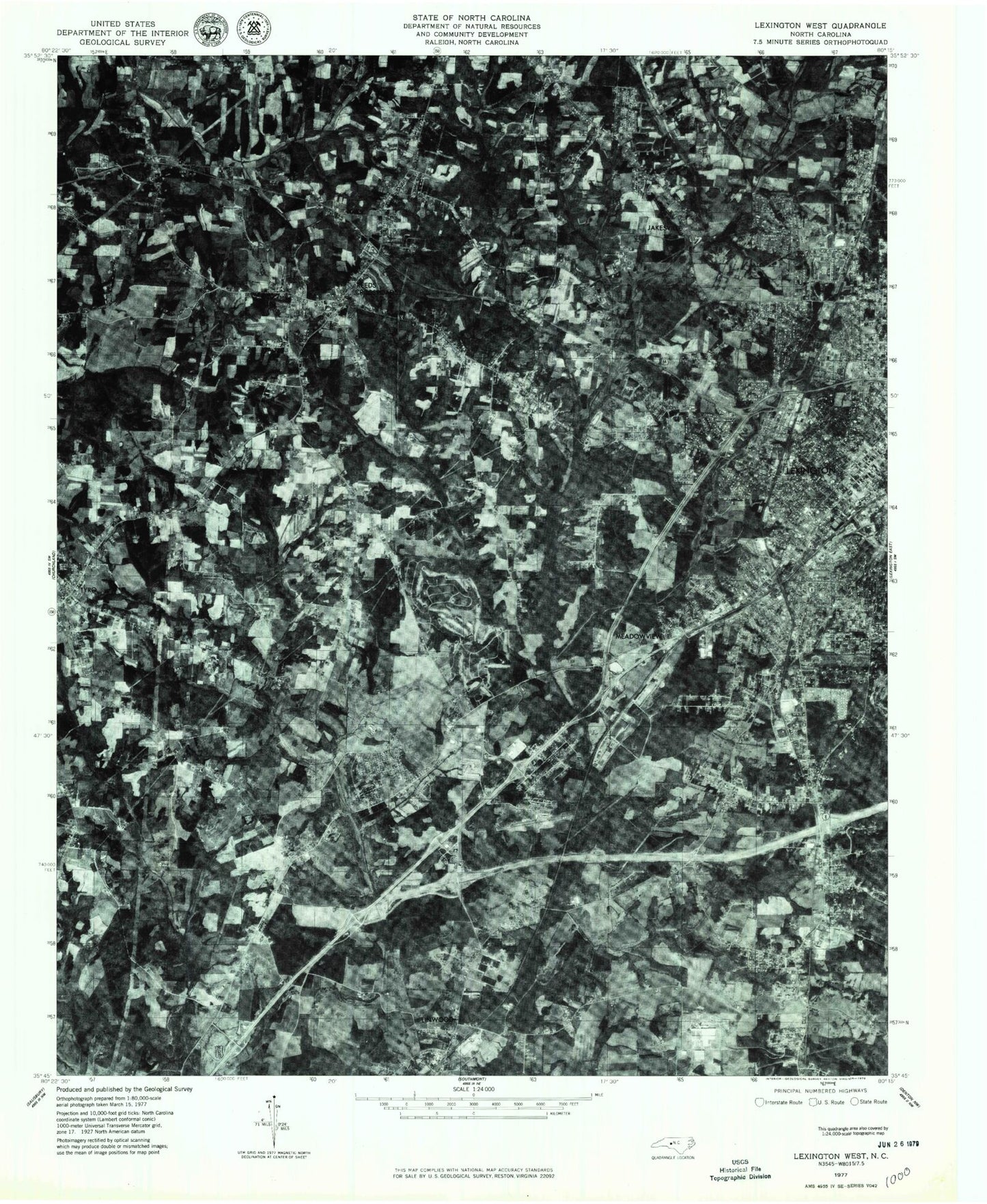
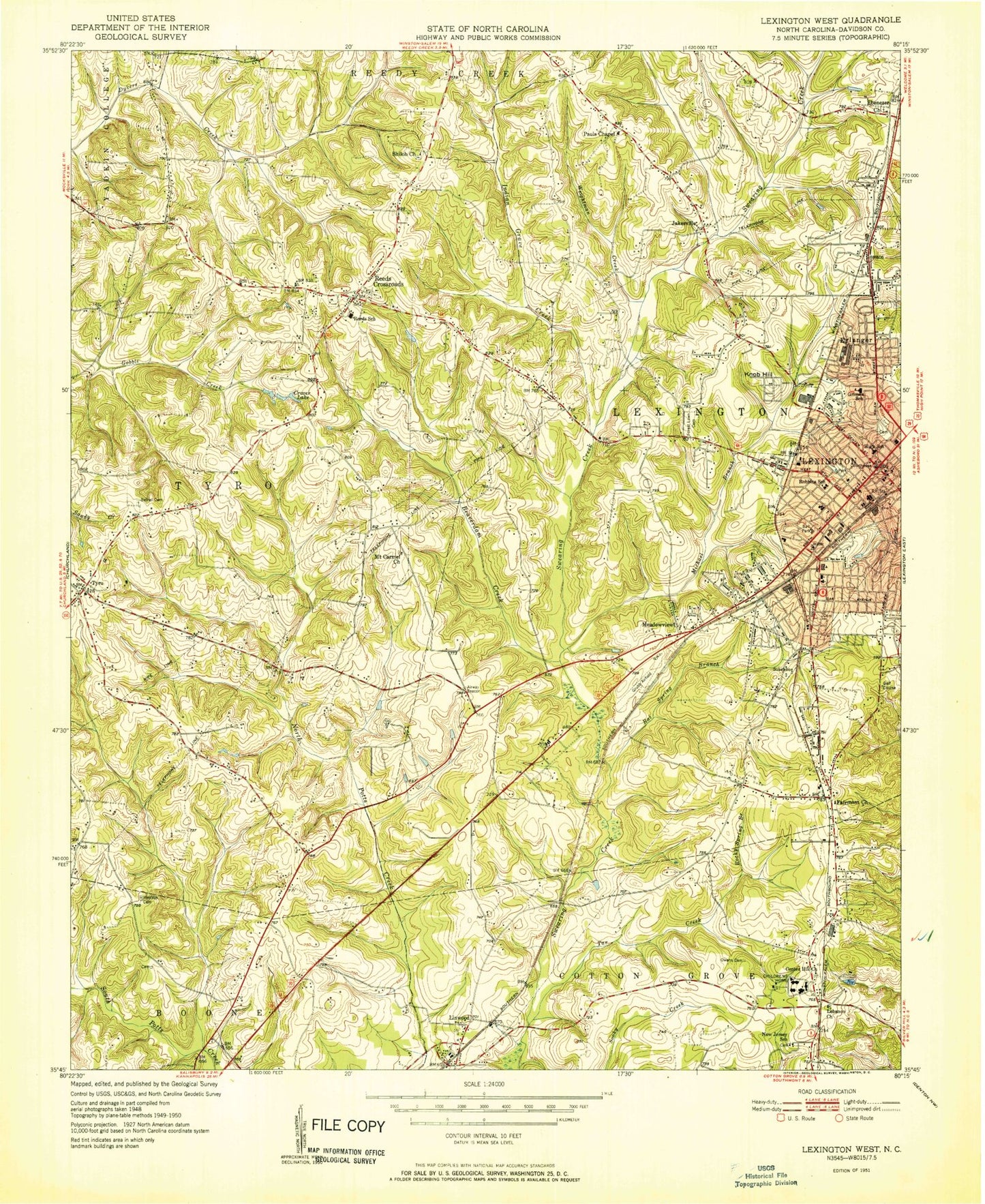
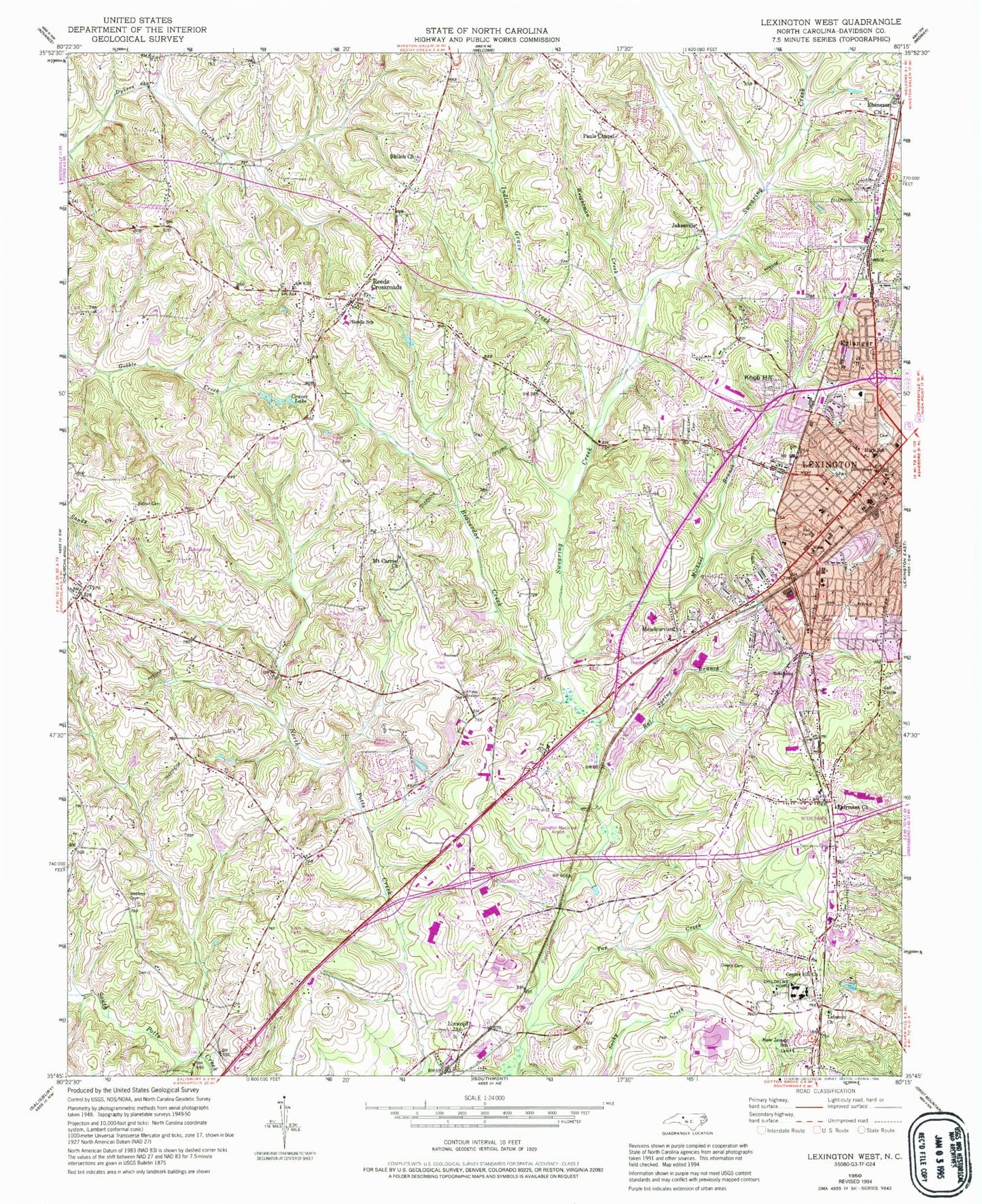
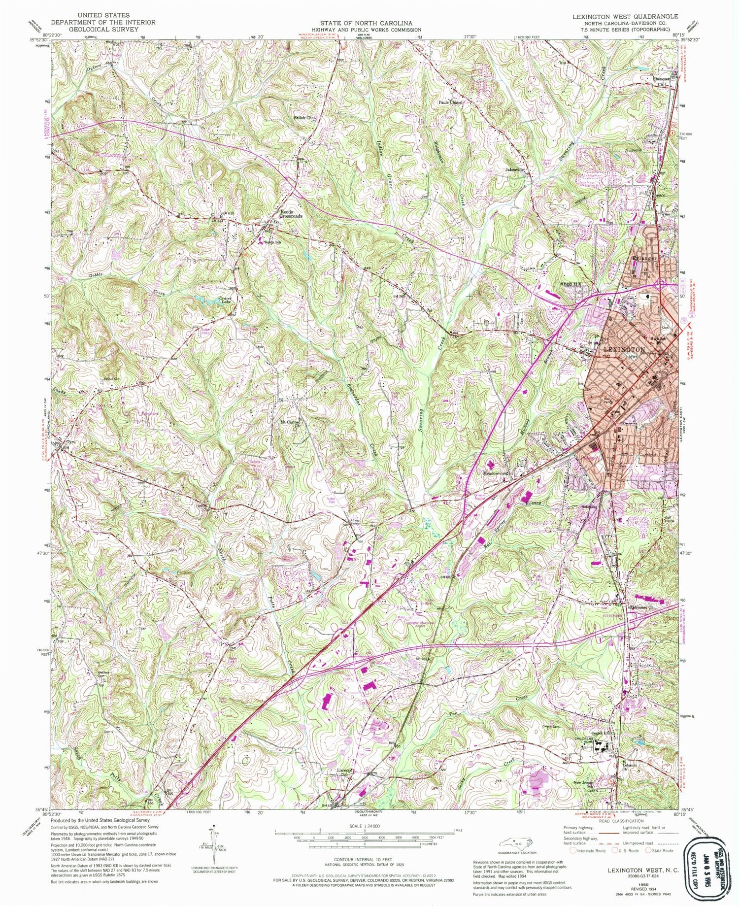
Historical USGS topographic quad map of Lexington West in the state of North Carolina. Map scale may vary for some years, but is generally around 1:24,000. Print size is approximately 24" x 27"
This quadrangle is in the following counties: Davidson.
The map contains contour lines, roads, rivers, towns, and lakes. Printed on high-quality waterproof paper with UV fade-resistant inks, and shipped rolled.
Contains the following named places: Beaverdam Creek, Bethel Cemetery, Beverly Street Park, Calvary Baptist Church, Carolina Pines, Center Hill Baptist Church, Childers Park, Choyce Acres, City of Lexington, Craver Lake, Davidson County Airport, Davidson County Courthouse, Davidson County Developmental Center, Dickerson Estates, Dunkers Creek, East Street Park, Ebenezer United Methodist Church, Emmanuel Wesleyan Methodist Church, Erlanger, Fairmont Presbyterian Church, Forest Lawn Cemetery, Fox Avenue Park, Freewood Acres, Glenwood, Glossens Lake Number Three, Glossens Lake Number Three Dam, Glossons Lake Dam Number One, Glossons Lake Number One, Glossons Lake Number One Dam, Glossons Lake Number Two Dam, Green Needles, Grimes Primary School, Hillcrest, Holt-Moffitt Park, Indian Grave Creek, J C Park, Jakesville, Kentwood, Knob Hill, Lebanon Church, Lexington, Lexington City Cemetery, Lexington Fire Department Station 1, Lexington Fire Department Station 3, Lexington Fire Station Number 2, Lexington Memorial Hospital, Lexington Municipal Golf Course, Lexington Police Department, Lexington Post Office, Lexington Shopping Center, Lineberger Acres, Lingle Lake, Lingle Lake Dam, Linwood, Linwood Post Office, Linwood Rural Fire Department, Linwood United Methodist Church, Meadowview, Meadowview Presbyterian Church, Meredith Square, Michael Branch, Montclair, Mount Carmel Methodist Church, New Jersey Cemetery, New Testament Baptist Church, Norlex Shopping Center, Northside, Northside Gardens, Northside Park, Owen Family Cemetery, Pauls Chapel United Church of Christ, Pickett Elementary, Piedmont Plaza Shopping Center, Pinecrest, Pleasant Hills, Radcliff Park, Random Woods, Rat Spring Branch, Reeds Baptist Church, Reeds Crossroads, Reeds Elementary School, Reeds Fire Department Station 51, Reeds Methodist Church, Robbins School, Rocky Spring Branch, Rolling Park, Royal Park, Sapona, Sapona Golf and Country Club, Sapona Lakes, Shiloh United Methodist Church, Smith Grove Baptist Church, Smith Street Park, South Lexington Fire Department, South Lexington Primary School, Southwood Elementary School, Tar Creek, Township of Lexington, Township of Tyro, Tyro, Tyro Baptist Church, Tyro Junior High School, Washington Park, Wayside Baptist Tabernacle, WBUY-AM (Lexington), Weightman Creek, Wescliff, Wesleys Cemetery, West Davidson Senior High School, West Lexington Fire and Rescue Station 71, West Ninth Avenue Park, Western Heights, Westover, Westside Baptist Church, Westwood, Whitesmith, Woodbriar Plaza Shopping Center, Woodcrest, ZIP Code: 27295