MyTopo
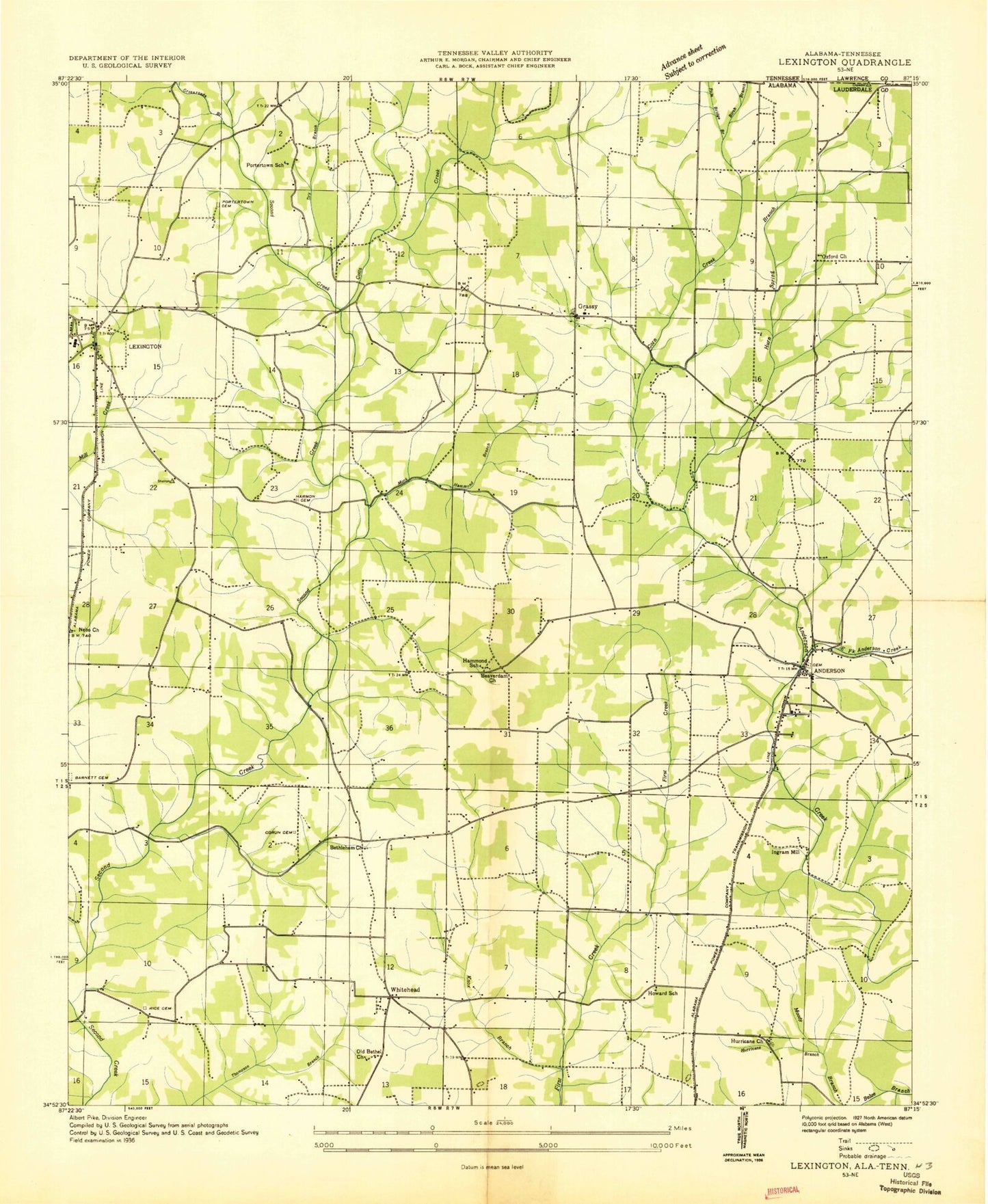
Classic USGS Lexington Alabama 7.5'x7.5' Topo Map
Couldn't load pickup availability
Historical USGS topographic quad map of Lexington in the state of Alabama. Map scale may vary for some years, but is generally around 1:24,000. Print size is approximately 24" x 27"
This quadrangle is in the following counties: Lauderdale, Lawrence.
The map contains contour lines, roads, rivers, towns, and lakes. Printed on high-quality waterproof paper with UV fade-resistant inks, and shipped rolled.
Contains the following named places: Anderson, Anderson Junior High School, Anderson Post Office, Anderson Volunteer Fire Department, Arthur Post Office, Barnett Cemetery, Beaverdam Branch, Beaverdam Church, Bethlehem Congregational Methodist Church, Bills Branch, Birch Branch, Brown Cemetery, Carter Spring, Cedar Hill, Cedar Hill School, Corn Branch, Corum, Corum Cemetery, Corum Chapel Missionary Baptist Church, Corum Hollow, Cotts Creek, Crossroads Branch, Dry Branch, East Fork Anderson Creek, Grassy, Grassy Church, Grassy Memorial Chapel Church, Grassy School, Hammond Branch, Hammond Cemetery, Hammond School, Harmon Cemetery, Herston Branch, Howard School, Hurn Spring, Hurn Spring Branch, Hurricane, Hurricane Branch, Hurricane Cumberland Presbyterian Church, Hurricane Springs Primitive Baptist Church, Ingram Ford, Ingram Mill, Ivy Bluff, Lexington, Lexington Fire Department, Lexington Police Department, Lexington Post Office, Lexington School, Locks Crossing Church of Christ, Marshall Branch, Middle Fork Anderson Creek, Monk Branch, Moody Ford, Nebo Cumberland Presbyterian Church, Nebo School, New Hope Baptist Church, Northside Church, Old Bethel Church, Oxford Church of Christ, Oxford School, Pole Bridge Branch, Portertown Cemetery, Portertown School, Powell, Rice Cemetery, Rogersville Division, Sawmill Hollow, Shelton Cemetery, Sledge Ford, Sledge Ford Bridge, Springfield Branch, Stout Hollow, Strickland Hollow, Town of Anderson, Town of Lexington, West Fork Anderson Creek, White Branch, Whitehead, Whitehead Church, Whitehead School, WWLX-AM (Lexington)