MyTopo
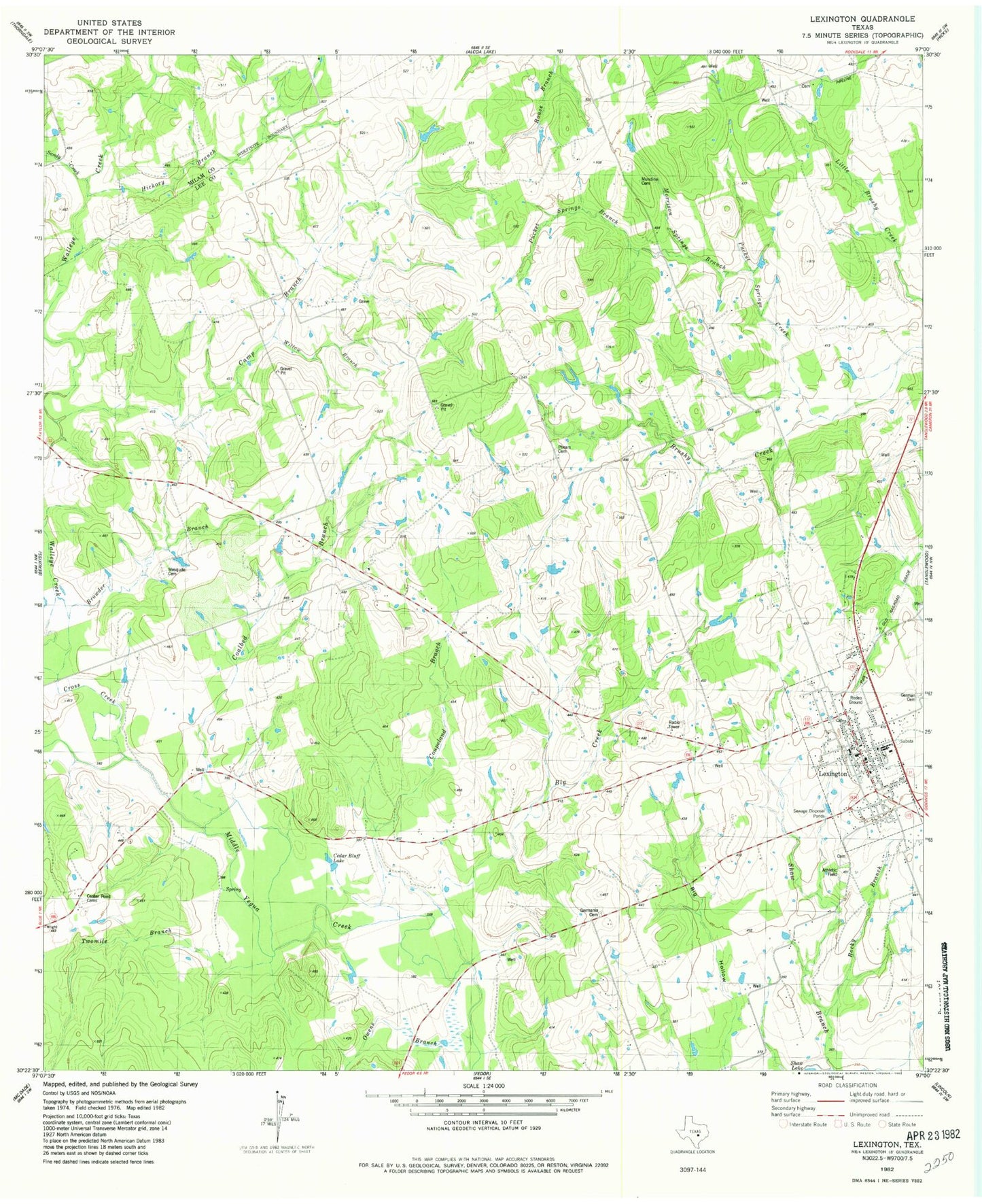
Classic USGS Lexington Texas 7.5'x7.5' Topo Map
Couldn't load pickup availability
Historical USGS topographic quad map of Lexington in the state of Texas. Map scale may vary for some years, but is generally around 1:24,000. Print size is approximately 24" x 27"
This quadrangle is in the following counties: Lee, Milam.
The map contains contour lines, roads, rivers, towns, and lakes. Printed on high-quality waterproof paper with UV fade-resistant inks, and shipped rolled.
Contains the following named places: Cameron Cemetery, Camp Branch, Caraway Lake Number 1, Caraway Lake Number 1 Dam, Caraway Lake Number 2, Caraway Lake Number 2 Dam, Center Point Cemetery, Cotton Patch Airport, Coupeland Branch, Cross Creek, German Cemetery, Germania Cemetery, Grapevine Gully, Lexington, Lexington City Hall, Lexington Division, Lexington Elementary School, Lexington High School, Lexington Middle School, Lexington Police Department, Lexington Post Office, Lexington Primary School, Lexington Volunteer Emergency Medical Service, Morrison Springs Branch, Mundine Cemetery, Owens Branch, Pucker Springs Branch, Pucker Springs Creek, Sandy Creek, Shaw Branch, Town of Lexington, Two Mile Branch, Walleye Creek, ZIP Code: 78947