MyTopo
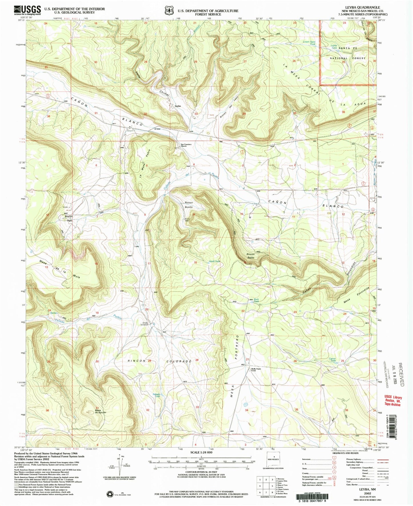
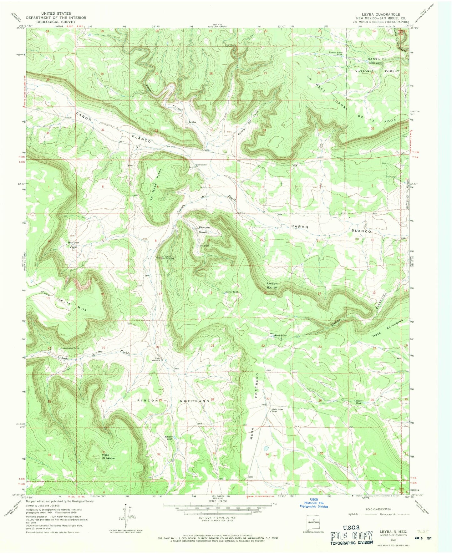
Classic USGS Leyba New Mexico 7.5'x7.5' Topo Map
Couldn't load pickup availability
Historical USGS topographic quad map of Leyba in the state of New Mexico. Map scale may vary for some years, but is generally around 1:24,000. Print size is approximately 24" x 27"
This quadrangle is in the following counties: San Miguel.
The map contains contour lines, roads, rivers, towns, and lakes. Printed on high-quality waterproof paper with UV fade-resistant inks, and shipped rolled.
Contains the following named places: Benada Tank, Blind Well, Canada de Pueblo, Corner Tank, El Pablito Indian Ruins, La Mesa Corral de la Agua, La Mesa Pobre, Leyba, Leyba Post Office, Leyba Tank, Lower Agua Tank, Mesa de Aguilar, Mesa de la Mula, Mesa Escondida, Mesa Portrero, North Tank, Ojo Indian Ruins, Rincon Bajito, Rincon Bonito, Rincon Colorado, Rincon del Leon, Rincon Vigil, Rock Tank, San Francisco Church, Shelly, Shelly Hayes Camp, Shelly Windmill, Valle Chimal, Villanueva Division, ZIP Code: 87560