MyTopo
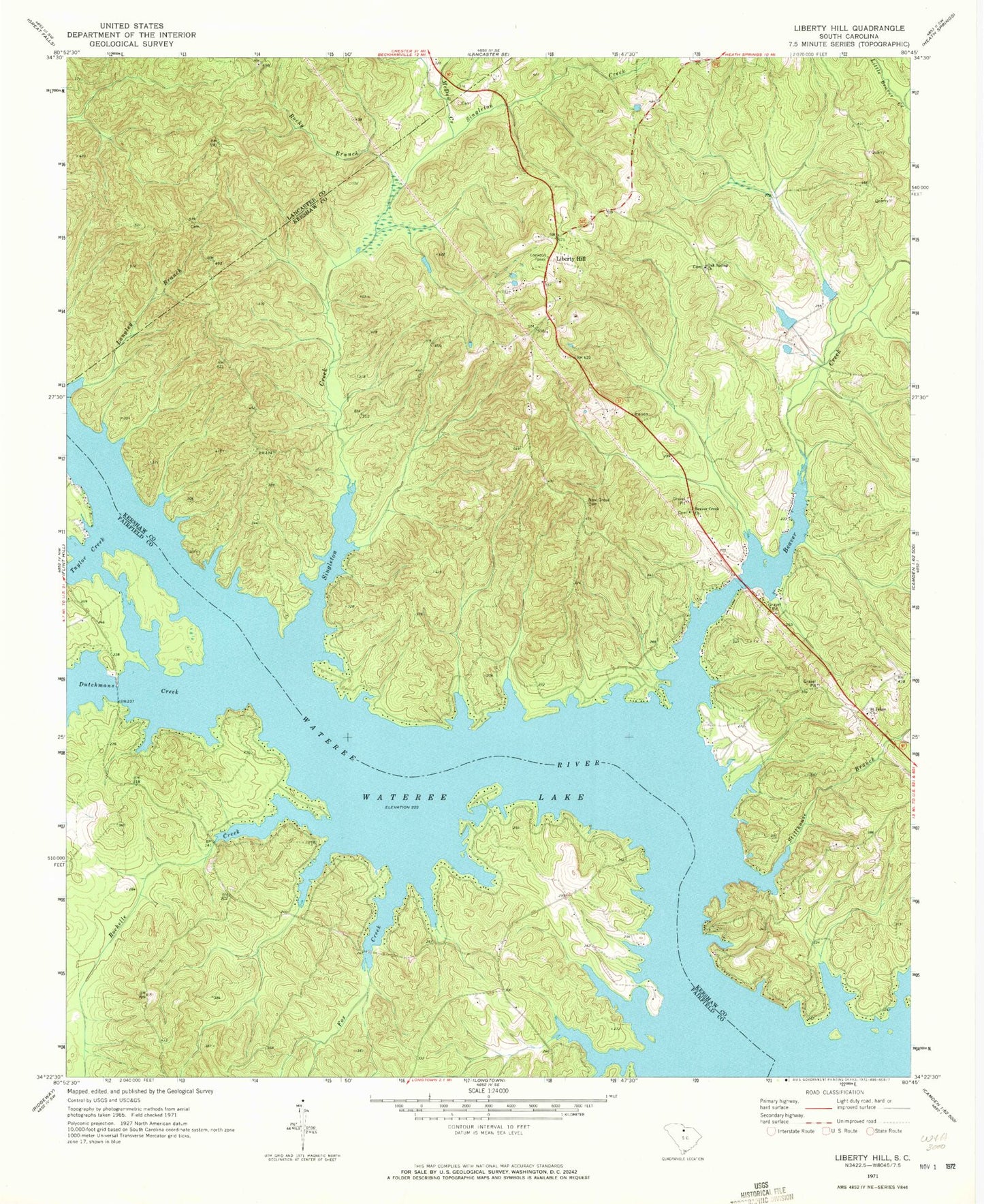
Classic USGS Liberty Hill South Carolina 7.5'x7.5' Topo Map
Couldn't load pickup availability
Historical USGS topographic quad map of Liberty Hill in the state of South Carolina. Typical map scale is 1:24,000, but may vary for certain years, if available. Print size: 24" x 27"
This quadrangle is in the following counties: Fairfield, Kershaw, Lancaster.
The map contains contour lines, roads, rivers, towns, and lakes. Printed on high-quality waterproof paper with UV fade-resistant inks, and shipped rolled.
Contains the following named places: Beaver Creek, Beaver Creek Church, Dutchmans Creek, Langley Branch, McDow Creek, New Grove Cemetery, Rocky Branch, Saint Johns Church, Stillhouse Branch, Wateree Lake, Hoods Mill (historical), Liberty Hill Church (historical), Liberty Hill Historic District, Liberty Hill Lookout Tower, Liberty Hill Presbyterian Church, Liberty Hill School (historical), Mickles Ferry (historical), Mineral Spring, New Grove Church (historical), Peays Ferry (historical), Lake Wateree State Park, Mount Moriah Church (historical), Thorn School (historical), Hilton House Pond Dam D-1139, Hilton House Pond, Gitsinger Church (historical), Summerville - Cunningham Cemetery, Liberty Hill, Fox Creek, Oak Spring Church, Rochelle Creek, Singleton Creek, Taylor Creek, Fairfield County Fire Department Number 8 Dutchman Creek, Kershaw County Fire Station 12