MyTopo
Classic USGS Liberty Hill Texas 7.5'x7.5' Topo Map
Couldn't load pickup availability
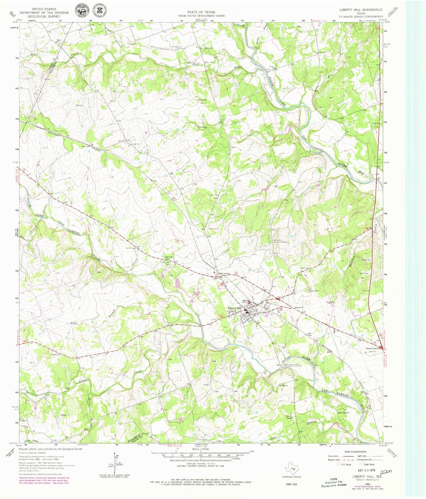
Historical USGS topographic quad map of Liberty Hill in the state of Texas. Map scale may vary for some years, but is generally around 1:24,000. Print size is approximately 24" x 27"
This quadrangle is in the following counties: Burnet, Travis, Williamson.
The map contains contour lines, roads, rivers, towns, and lakes. Printed on high-quality waterproof paper with UV fade-resistant inks, and shipped rolled.
Contains the following named places: Bear Creek, Big Branch, Brewer Branch, Bullion Branch, Cementerio de las Tres Marias, Church of Christ, City of Liberty Hill, Clear Creek, Connell Cemetery At Bear Creek, Dog Branch, Flying H Ranch Airport, Jenkins Branch, Jinks Branch, KBTS-FM (Killeen), KLTD-FM (Lampasas), Lackey Creek, Liberty Chapel, Liberty Hill, Liberty Hill Cemetery, Liberty Hill City Hall, Liberty Hill Fire Department, Liberty Hill Post Office, Little Creek, Martha Chapman Dam, Meridell Achievement Center, Potts Branch, San Gabriel River Ranch Lake, San Gabriel River Ranch Lake Dam, Seward Junction, Westwood Special Education, Williams - Buck Cemetery, Wilson Branch, ZIP Code: 78642