MyTopo
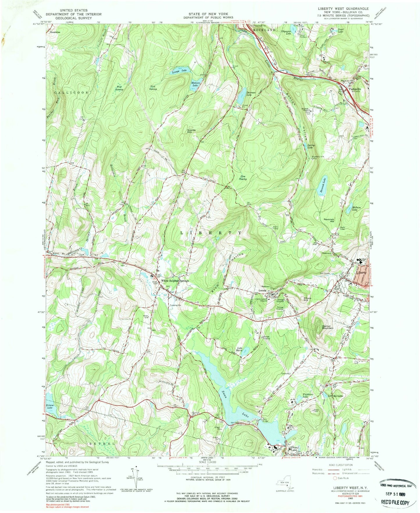
Classic USGS Liberty West New York 7.5'x7.5' Topo Map
Couldn't load pickup availability
Historical USGS topographic quad map of Liberty West in the state of New York. Map scale may vary for some years, but is generally around 1:24,000. Print size is approximately 24" x 27"
This quadrangle is in the following counties: Sullivan.
The map contains contour lines, roads, rivers, towns, and lakes. Printed on high-quality waterproof paper with UV fade-resistant inks, and shipped rolled.
Contains the following named places: Achieve Rehabilitation and Nursing Facility, All Souls Chapel, Benton Hollow, Blueberry Hill Camp, Briscoe Lake, Camp Olympus, Chuck Hill, Denman Lake, Fieldston Lake, Grants Hill, Hi Brow Horse Farm, Horseshoe Brook, Kelly Bridge, Kingdom Hall of Jehovahs Witnesses, Krom Hollow, Lake Barnabee, Lake Marie, Laurel Hill Cemetery, Lenape Lake, Liberty Baptist Church, Liberty Free Methodist Church, Liberty High School, Liberty Middle School, Liberty-Loomis Hospital, Light and Life Christian School, Loomis, Loomis Mobile Home Park, Matawa Lake, Melbern Lake, Old Parksville Cemetery, Olympus Lake, Parksville, Parksville Methodist Church Cemetery, Parksville Post Office, Pearl Lake, Pine Swamp, Revonah Hill, Revonah Lake, School Number 12, Shingle Brook, Spring Lake, Sullivan County Golf and Country Club, Swan Lake, Swan Lake Cemetery, Swan Lake Census Designated Place, Swan Lake Post Office, Swan Lake Volunteer Fire Department, Town of Liberty, Walnut Mountain, Walnut Mountain Farm And Nursery, White Sulphur Springs, White Sulphur Springs Cemetery, White Sulphur Springs Fire Department, White Sulphur Springs Post Office, WJFF-FM (Jeffersonville), ZIP Code: 12787