
MyTopo
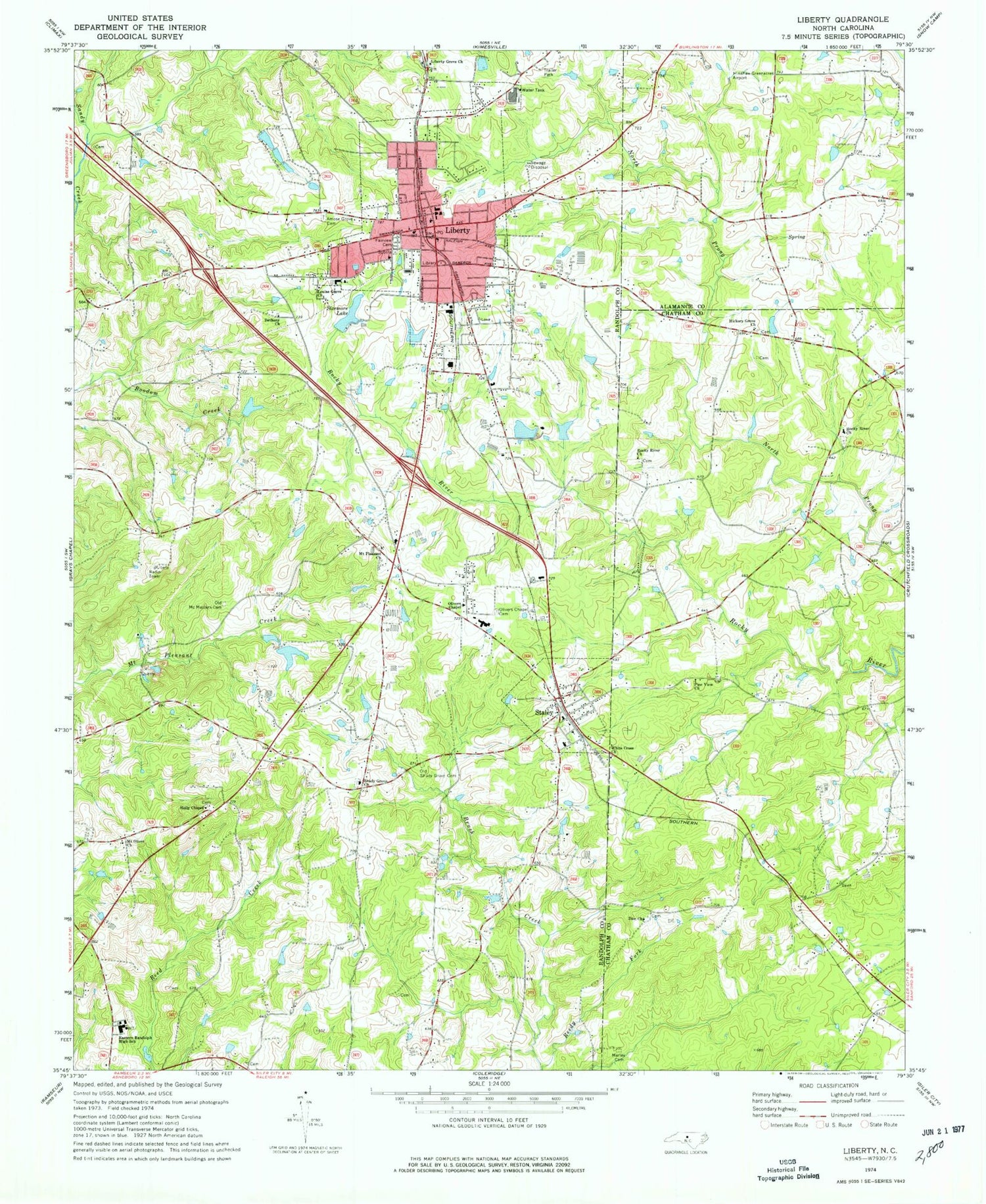
Classic USGS Liberty North Carolina 7.5'x7.5' Topo Map
Couldn't load pickup availability
Historical USGS topographic quad map of Liberty in the state of North Carolina. Map scale may vary for some years, but is generally around 1:24,000. Print size is approximately 24" x 27"
This quadrangle is in the following counties: Alamance, Chatham, Randolph.
The map contains contour lines, roads, rivers, towns, and lakes. Printed on high-quality waterproof paper with UV fade-resistant inks, and shipped rolled.
Contains the following named places: Amose Grove Cemetery, Bethany Church, Eastern Randolph High School, Fairview Cemetery, Fox Turkey Farm, Gilmore Plant and Bulb Farm, Hickory Grove Church, Holly Chapel, Kennedy Lake, Kennedy Lake Dam, Langley Dairy Farm, Liberty, Liberty Elementary School, Liberty Fire Department, Liberty Grove Church, Liberty Police Department, Liberty Post Office, Louise Grove Church, Marley Cemetery, Mount Olivet Church, Mount Pleasant Church, Old McMasters Cemetery, Old Shady Grove Cemetery, Olivers Chapel, Olivers Chapel Cemetery, Overman Lake Dam, Patterson Lake, Patterson Lake Dam, Pine View Church, Randolph County Emergency Medical Services - Liberty, Reedy Fork, Rocky River Church, Shady Grove Church, Sizemore Lake, Sizemore Lake Dam, Snow Camp Volunteer Fire Department Station 15, Staley, Staley Post Office, Staley Volunteer Fire Department Station 7, Town of Liberty, Town of Staley, Township of Columbia, Township of Liberty, Wayne Isley Dam, Wayne Isley Lake, White Cross Church, Zion Church, ZIP Code: 27355


