MyTopo
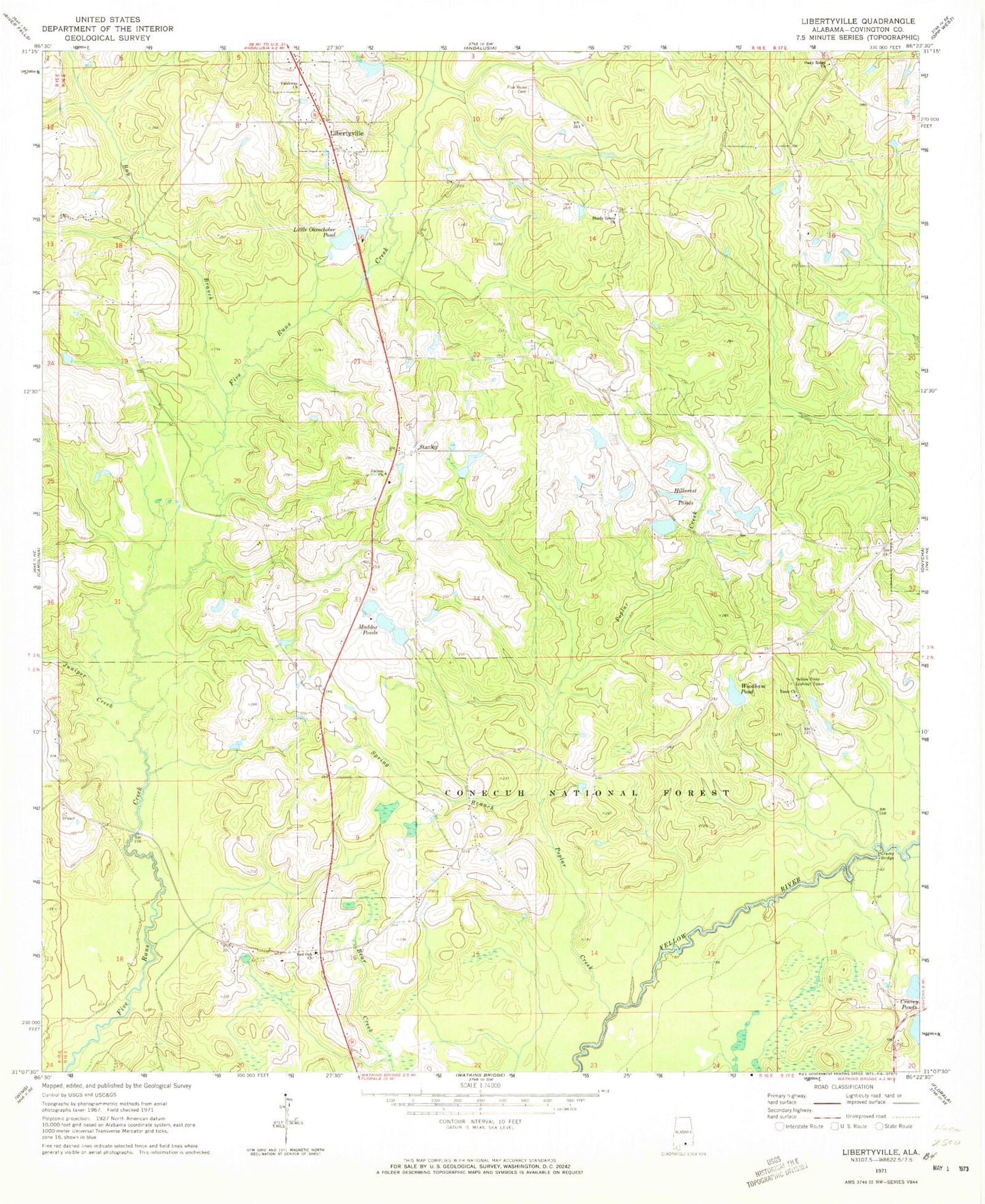
Classic USGS Libertyville Alabama 7.5'x7.5' Topo Map
Couldn't load pickup availability
Historical USGS topographic quad map of Libertyville in the state of Alabama. Map scale may vary for some years, but is generally around 1:24,000. Print size is approximately 24" x 27"
This quadrangle is in the following counties: Covington.
The map contains contour lines, roads, rivers, towns, and lakes. Printed on high-quality waterproof paper with UV fade-resistant inks, and shipped rolled.
Contains the following named places: Bay Branch, Charles Woodham Lake Dam, Clear Creek Church, Clifton Maddox Dam, Covington County, Cravey Bridge, Cravey Ponds, Elliotts Quarters, Enon Church, Faithway Church, Five Runs Cemetery, Five Runs Church, Gospel Center Church, Hillcrest Pond, Hillcrest Pond Number 1 Dam, Hillcrest Pond Number 2 Dam, Hillcrest Ponds, Judson Baptist Church, Judson Cemetery, Juniper Creek, Kersey Pond, Lakeview, Libertyville, Libertyville Volunteer Fire Department, Little Okeechobee Pond, Maddox Ponds, New Shady Grove Church, Oakey Ridge Baptist Church, Oakey Ridge Cemetery, Poplar Creek, Red Oak, Red Oak Church, Red Oak Volunteer Fire Department, Shady Grove Church, Shiloh Church, Spring Branch, Stanley, Town of Libertyville, Woodham Pond, Yellow River Lookout Tower