MyTopo
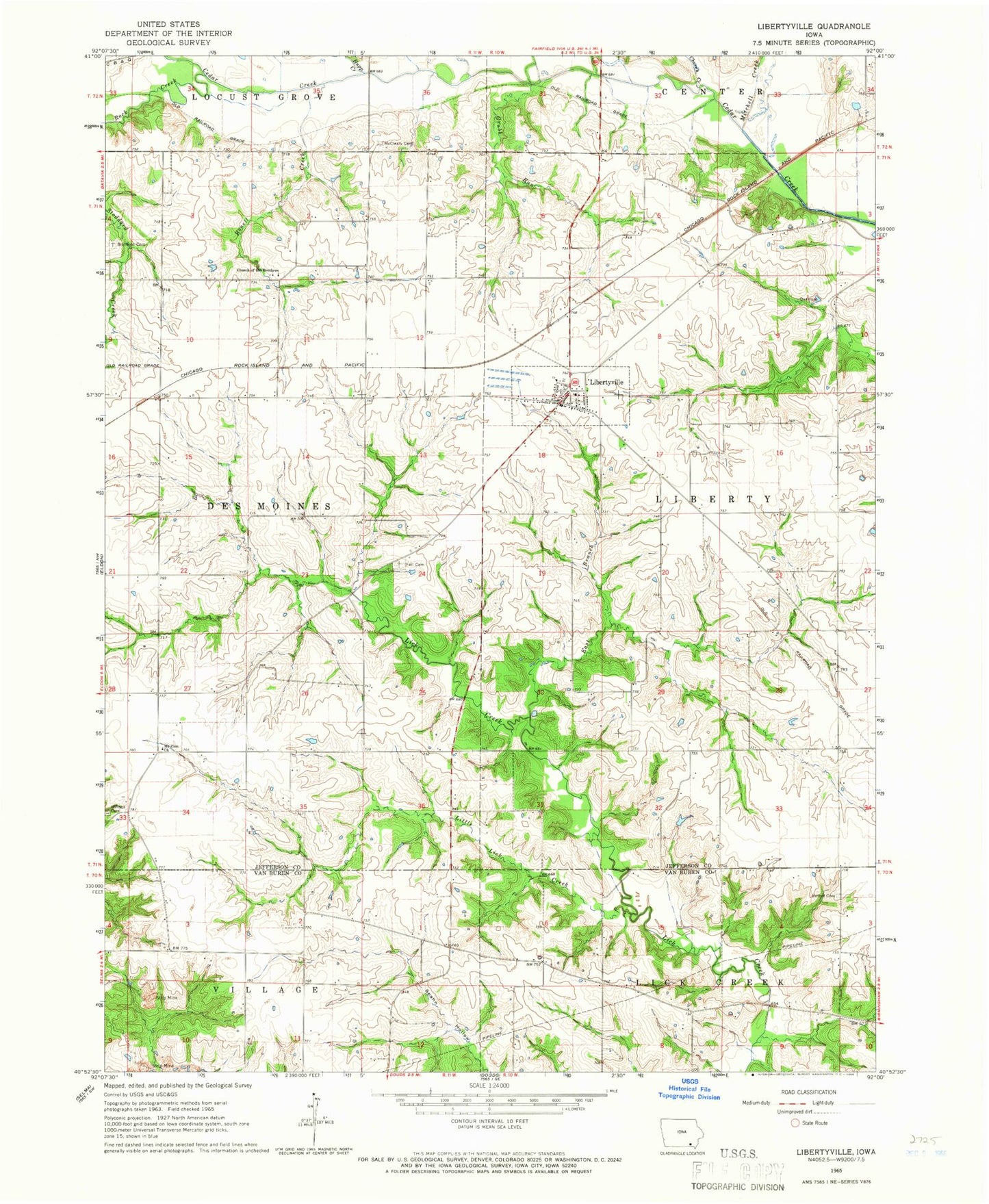
Classic USGS Libertyville Iowa 7.5'x7.5' Topo Map
Couldn't load pickup availability
Historical USGS topographic quad map of Libertyville in the state of Iowa. Map scale may vary for some years, but is generally around 1:24,000. Print size is approximately 24" x 27"
This quadrangle is in the following counties: Jefferson, Van Buren.
The map contains contour lines, roads, rivers, towns, and lakes. Printed on high-quality waterproof paper with UV fade-resistant inks, and shipped rolled.
Contains the following named places: Bethel Cemetery, Bonell Creek, Brethren Cemetery, Cedar Creek Timber Recreation Area, Church Creek, City of Libertyville, Dragoon Trail Historical Marker, East Branch Lick Creek, Ellmaker, Faith United Methodist Church, Fell Cemetery, Grubb Run, Hupp Creek, KIIK-FM (Fairfield), Krum Post Office, Libertyville, Libertyville City Hall, Libertyville Elementary School, Libertyville Fire and Rescue, Libertyville Post Office, Little Lick Creek, McCleary Cemetery, Mitchell Creek, Mount Zion Church, Rock Creek, Smith Cemetery, Sunnybrook Assisted Living Center, Township of Des Moines, Township of Liberty, Whitefield, Whitfield Post Office, Winsell Cemetery, ZIP Code: 52567