MyTopo
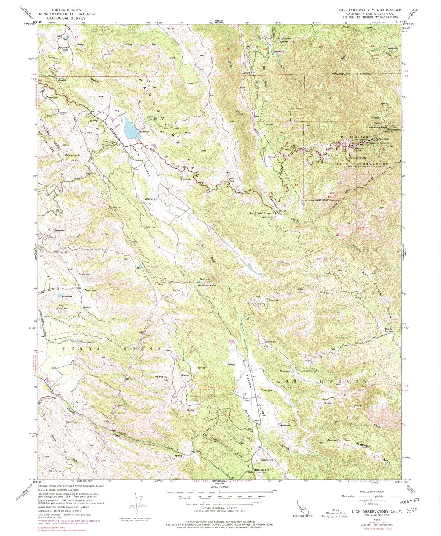
Classic USGS Lick Observatory California 7.5'x7.5' Topo Map
Couldn't load pickup availability
Historical USGS topographic quad map of Lick Observatory in the state of California. Typical map scale is 1:24,000, but may vary for certain years, if available. Print size: 24" x 27"
This quadrangle is in the following counties: Santa Clara.
The map contains contour lines, roads, rivers, towns, and lakes. Printed on high-quality waterproof paper with UV fade-resistant inks, and shipped rolled.
Contains the following named places: Bonita Creek, Cow Creek, Divide Springs, Halls Valley, Mount Hamilton, Highland School, Hog Slough, Lick Observatory, Long Branch, Masters Hill, Mount Misery, Mount Hamilton Springs, Panochita Hill, San Felipe Hills, San Felipe Valley, Smith Creek Ranger Station, Canada De Pala, Sulphur Creek, Crossley Reflector, Copernicus Peak, Grant Company Number 2 1057-002 Dam, Halls Valley Lake, Kuhn 624 Dam, San Felipe Ranch 1621 Dam, Alexander Ranch, Coe Ranch, Evergreen Ranch, Grant Ranch, Halls Valley School (historical), Hendricks Ranch, Kuhn Ranch, Richmond Ranch, Scott Ranch, Joseph D Grant County Park, Silver Creek Valley Country Club, Copernicus Peak Lookout Tower, Evergreen Elementary School, Tom Matsumoto Elementary School, Chaboya Middle School, CAL FIRE Smith Creek Fire Station 12 Santa Clara Unit