MyTopo
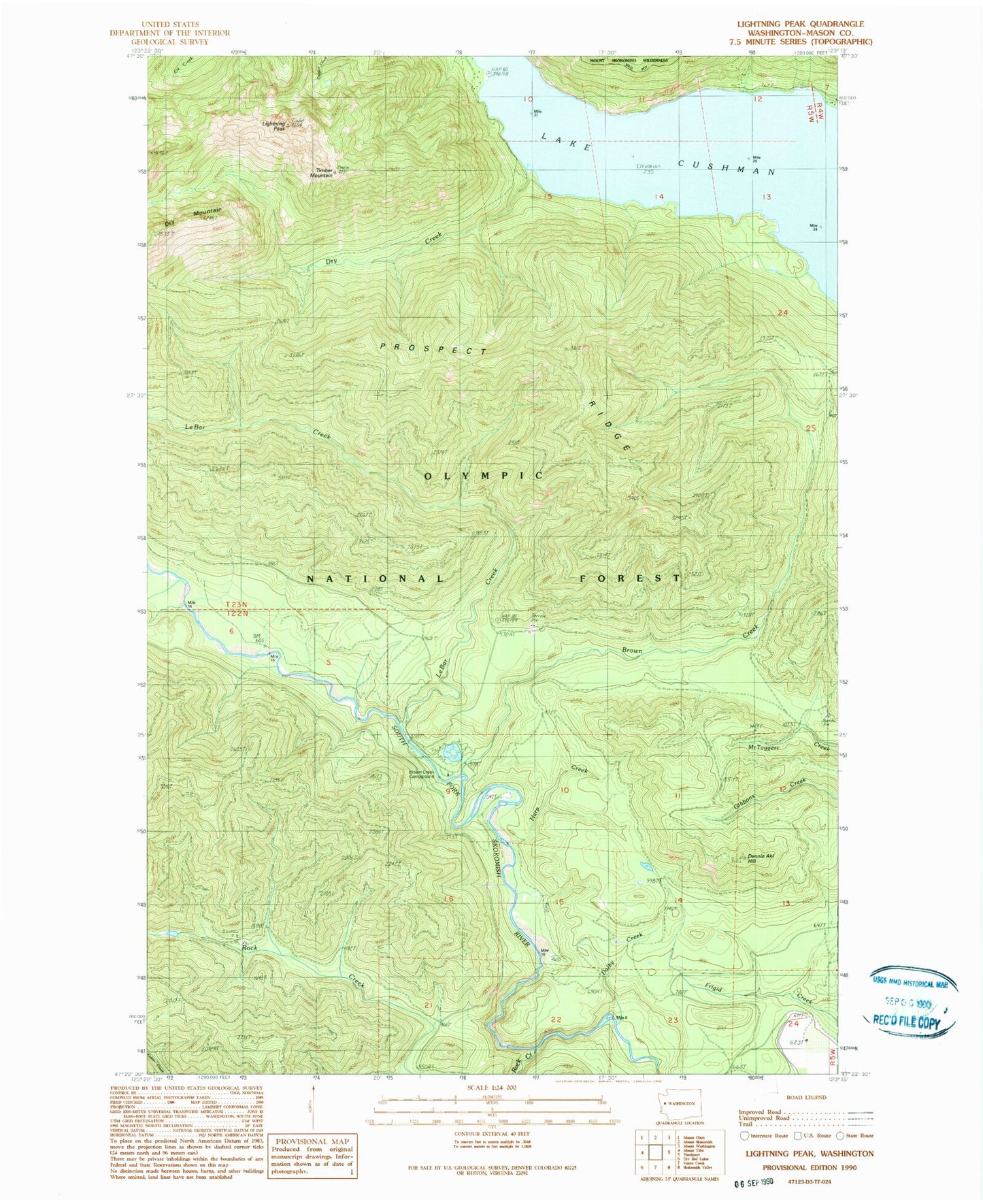
Classic USGS Lightning Peak Washington 7.5'x7.5' Topo Map
Couldn't load pickup availability
Historical USGS topographic quad map of Lightning Peak in the state of Washington. Typical map scale is 1:24,000, but may vary for certain years, if available. Print size: 24" x 27"
This quadrangle is in the following counties: Mason.
The map contains contour lines, roads, rivers, towns, and lakes. Printed on high-quality waterproof paper with UV fade-resistant inks, and shipped rolled.
Contains the following named places: Brown Creek, Brown Creek Campground, Lake Cushman, Dalby Creek, Dennie Ahl Hill, Dry Creek, Rock Creek, Harp Creek, Intermount Guard Station (historical), Le Bar Creek, Le Bar Guard Station (historical), Lightning Peak, Prospect Ridge, Timber Mountain, Dennie Ahl Seed Orchard, Dennie Ahl Hill Lookout, West Mason Division