MyTopo
Classic USGS Ligon Ranch Texas 7.5'x7.5' Topo Map
Regular price
$16.95
Regular price
Sale price
$16.95
Unit price
per
Couldn't load pickup availability
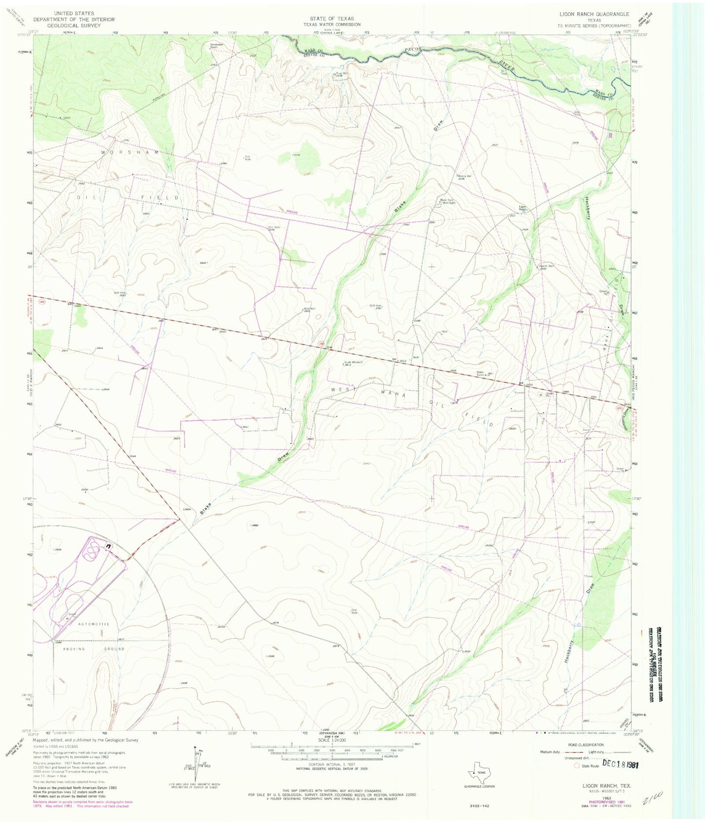
Historical USGS topographic quad map of Ligon Ranch in the state of Texas. Map scale may vary for some years, but is generally around 1:24,000. Print size is approximately 24" x 27"
This quadrangle is in the following counties: Pecos, Reeves, Ward.
The map contains contour lines, roads, rivers, towns, and lakes. Printed on high-quality waterproof paper with UV fade-resistant inks, and shipped rolled.
Contains the following named places: Alberts Well, Blake Draw, Boyd Family Cemetery, Hackberry Draw, Ligon Ranch, Middle Well, Smithers Emitter Site, South Windmill, West Waha Oil Field, West Windmill