MyTopo
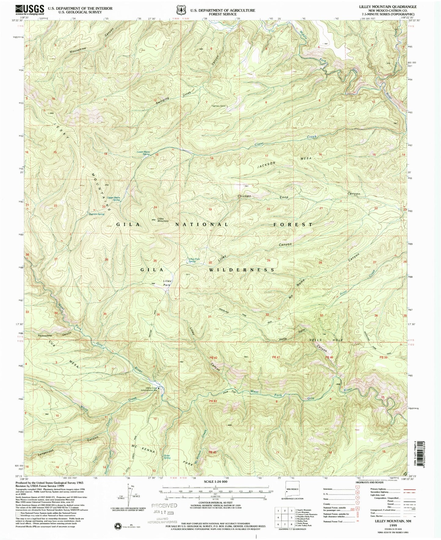
USGS Classic Lilley Mountain New Mexico 7.5'x7.5' Topo Map
Couldn't load pickup availability
Historical USGS topographic quad map of Lilley Mountain in the state of New Mexico. Scale: 1:24000. Print size: 24" x 27"
This quadrangle is in the following counties: Catron.
The map contains contour lines, roads, rivers, towns, lakes, and grids including latitude / longitude and UTM / MGRS. Printed on high-quality waterproof paper with UV fade-resistant inks.
Contains the following named places: Lilley Mountain, Canyon Creek, Clear Creek, Flying V Canyon, Hells Hole, Hells Hole, Horse Spring, Jackson Mesa, Langstroth Canyon, Lilley Canyon, Lilley Canyon, Lilley Park, Lilley Park Spring, Marrs Spring, McKenna Creek, No Name Canyon, Packsaddle Canyon, Papineau Grave, Pine Flat, Swinging Cross Canyon, Trail Creek, Trotter Cabin, Trotter Trail, White Creek, White Creek Cabin, Hells Hole Canyon, Quentin Spring, Lower Marrs Spring, Jerky Mountains, Rawmeat Creek, Upper Marrs Spring