MyTopo
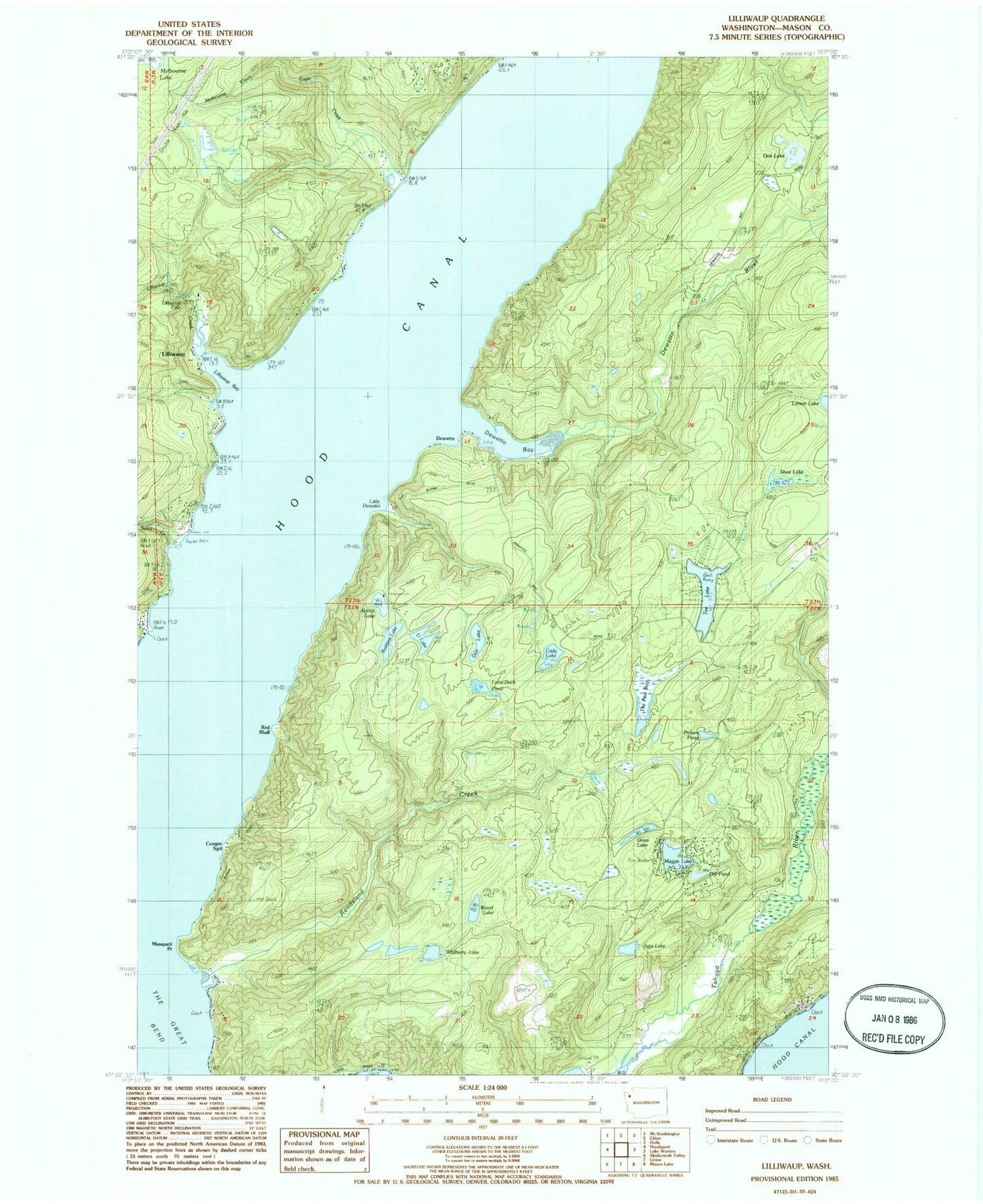
Classic USGS Lilliwaup Washington 7.5'x7.5' Topo Map
Couldn't load pickup availability
Historical USGS topographic quad map of Lilliwaup in the state of Washington. Typical map scale is 1:24,000, but may vary for certain years, if available. Print size: 24" x 27"
This quadrangle is in the following counties: Mason.
The map contains contour lines, roads, rivers, towns, and lakes. Printed on high-quality waterproof paper with UV fade-resistant inks, and shipped rolled.
Contains the following named places: Aldrich Lake, Cady Lake, Cougar Spit, Dewatto, Dewatto Bay, Dewatto River, Don Lake, Dry Pond, Eagle Creek, Jiggs Lake, Larson Lake, Lilliwaup, Lilliwaup Bay, Lilliwaup Creek, Lilliwaup Falls, Lone Duck Pond, Maggie Lake, Miller Creek, Musqueti Point, Grass Lake, Oak Lake, Red Bluff, Rendsland Creek, Robbins Lake, Shoe Lake, Sund Creek, Tahuya School, Tee Lake, U Lake, Wildberry Lake, Wood Lake, Pickers Pond, Melbourne Creek, The Peat Bog, Little Dewatto, Long Point, Melbourne Lake Dam, Rest - A - While Recreational Vehicle Park, Rest - A - While Mobile Home Park, Rest - A - While Marina, North Mason Regional Fire Authority Station 83, North Mason Regional Fire Authority Station 82, Mason County Fire District 2, North Mason Regional Fire Authority Station 28, Lilliwaup Post Office