MyTopo
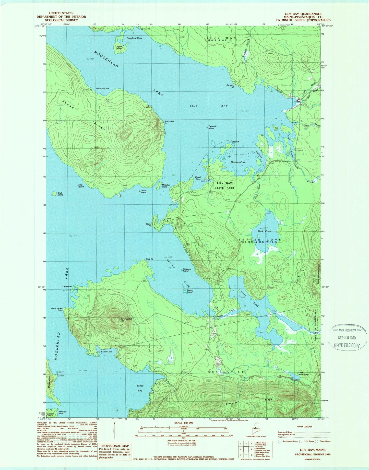
Classic USGS Lily Bay Maine 7.5'x7.5' Topo Map
Couldn't load pickup availability
Historical USGS topographic quad map of Lily Bay in the state of Maine. Typical map scale is 1:24,000, but may vary for certain years, if available. Print size: 24" x 27"
This quadrangle is in the following counties: Piscataquis.
The map contains contour lines, roads, rivers, towns, and lakes. Printed on high-quality waterproof paper with UV fade-resistant inks, and shipped rolled.
Contains the following named places: Beaver Cove, Beaver Creek, Birch Island, Birch Point, Black Point, Bolton Cove, Burgess Brook, Burnt Jacket Mountain, Burnt Jacket Point, Caribou Point, Carleton Point, Dollar Island, Doughnut Cove, Galusha Cove, Hyde Island, Laker Point, Lily Bay, Lily Bay Brook, Lily Bay State Park, Little Mud Pond, Mathews Cove, McCuller Island, Mud Brook, Mud Cove, Mud Pond, North Brook, Porcupine Point, Prong Pond, Rowell Cove, Sandy Bay, Scammon Ridge, Ship Island, Snake Island, South Brook, Sugar Island, Treasure Island, Tussle Brook, Tussle Lagoon, Twomile Island, Lily Bay