MyTopo
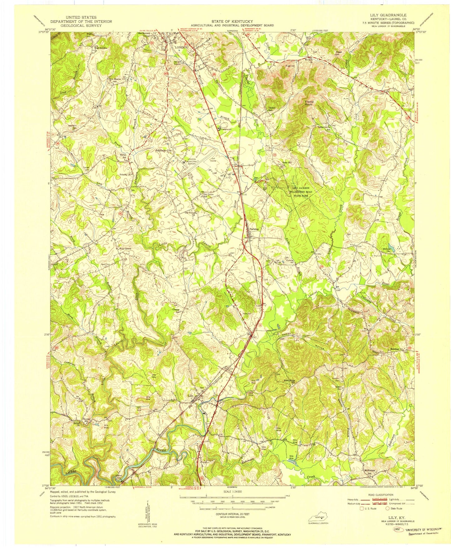
Classic USGS Lily Kentucky 7.5'x7.5' Topo Map
Couldn't load pickup availability
Historical USGS topographic quad map of Lily in the state of Kentucky. Map scale may vary for some years, but is generally around 1:24,000. Print size is approximately 24" x 27"
This quadrangle is in the following counties: Laurel.
The map contains contour lines, roads, rivers, towns, and lakes. Printed on high-quality waterproof paper with UV fade-resistant inks, and shipped rolled.
Contains the following named places: Bethel Church, Boreing, Branham Mill, Brays Cemetery, Calloway Creek, Camp Ground School, Campbell Branch, Campground Fire Department, City of London, Cloyd Branch, Corinth Baptist Church, Cumberland Memorial Gardens, Daniel Boone National Forest London Ranger District, Dorthae Dam, Dyche Memorial Park, Fariston, Fariston Railroad Station, Frantz Railroad Station, Frazier Knob, Full Gospel Tabernacle, Gilbert Chapel, Happy Hollow, Hopkins Cemetery, Horse Branch, Hyde Cemetery, Laurel County, Laurel County Fairgrounds, Laurel County Fire Department Station 1, Laurel County High School, Levi Jackson Wilderness Road State Park, Lick Branch, Lick Creek, Lily, Lily Post Office, Lily Railroad Station, Lily Volunteer Fire Department Station 1, Lily Volunteer Fire Department Station 2, Little Laurel River, Little Robinson Creek, Locke Branch, London Country Club, London District Ranger Office, London Division, London Fire Department, London Post Office, London-Corbin Airport-Magee Field, London-Corbin War Memorial, McHargue, McHargues Mill, Modrell Blockhouse, Mount Zion Church, North Corbin Division, Old Union Holiness Church, Owsley Cemetery, Pine Grove, Primity Church, Queens Branch, Queens Cemetery, Robinson Creek, Rocky Knob, Rough Creek, Sallys Branch, Sampson Branch, Slate Hill Church, Slate Ridge Bible Church, South Fariston Church, Southern Area Incident Support Cache, State Fire Rescue Training, Sublimity City, Sublimity School, Sue Bennett College, Tec Field, Ward Branch, Ward Cemetery, West London Church, Whitley Branch, Whittaker Cemetery, Wigington Cemetery, ZIP Codes: 40737, 40740, 40743, 40744