MyTopo
Classic USGS Lime Mountain California 7.5'x7.5' Topo Map
Couldn't load pickup availability
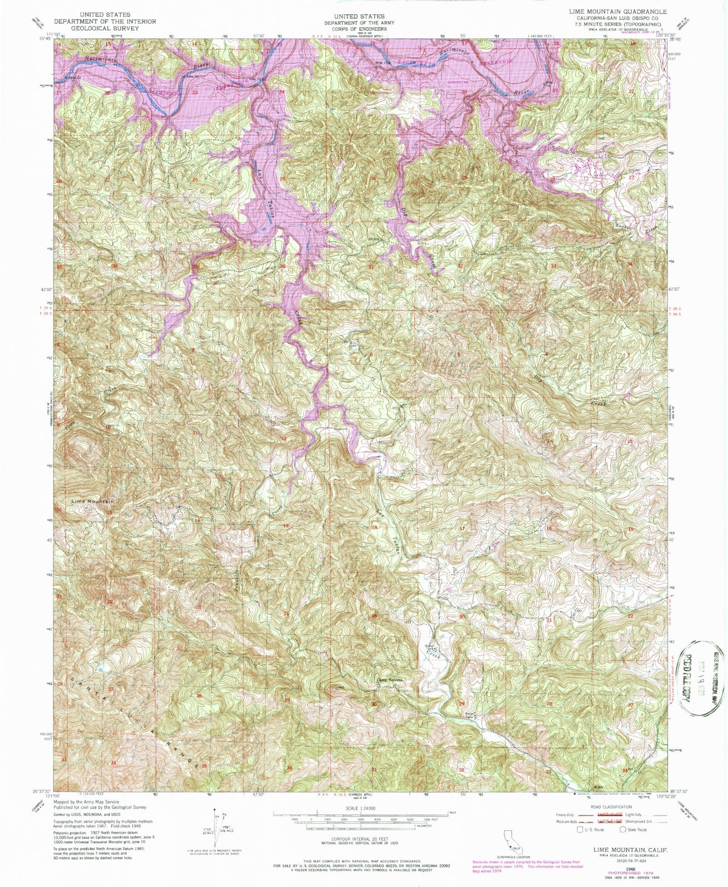
Historical USGS topographic quad map of Lime Mountain in the state of California. Map scale may vary for some years, but is generally around 1:24,000. Print size is approximately 24" x 27"
This quadrangle is in the following counties: San Luis Obispo.
The map contains contour lines, roads, rivers, towns, and lakes. Printed on high-quality waterproof paper with UV fade-resistant inks, and shipped rolled.
Contains the following named places: California Department of Forestry and Fire Protection Station 33 Heritage, California Department of Forestry and Fire Protection Station 35 Las Tablas, Camp Natoma, Cappy Culver Elementary School, Dip Creek, Franklin Creek, Heritage Lake Marina, Klau, Lake Nacimiento, Las Tablas Creek, Las Tablas Creek 742 Dam, Lime Mountain, Lime Mountain Quarry, Snake Creek, Town Creek, Turkey Cove Marina, Williams Ranch