MyTopo
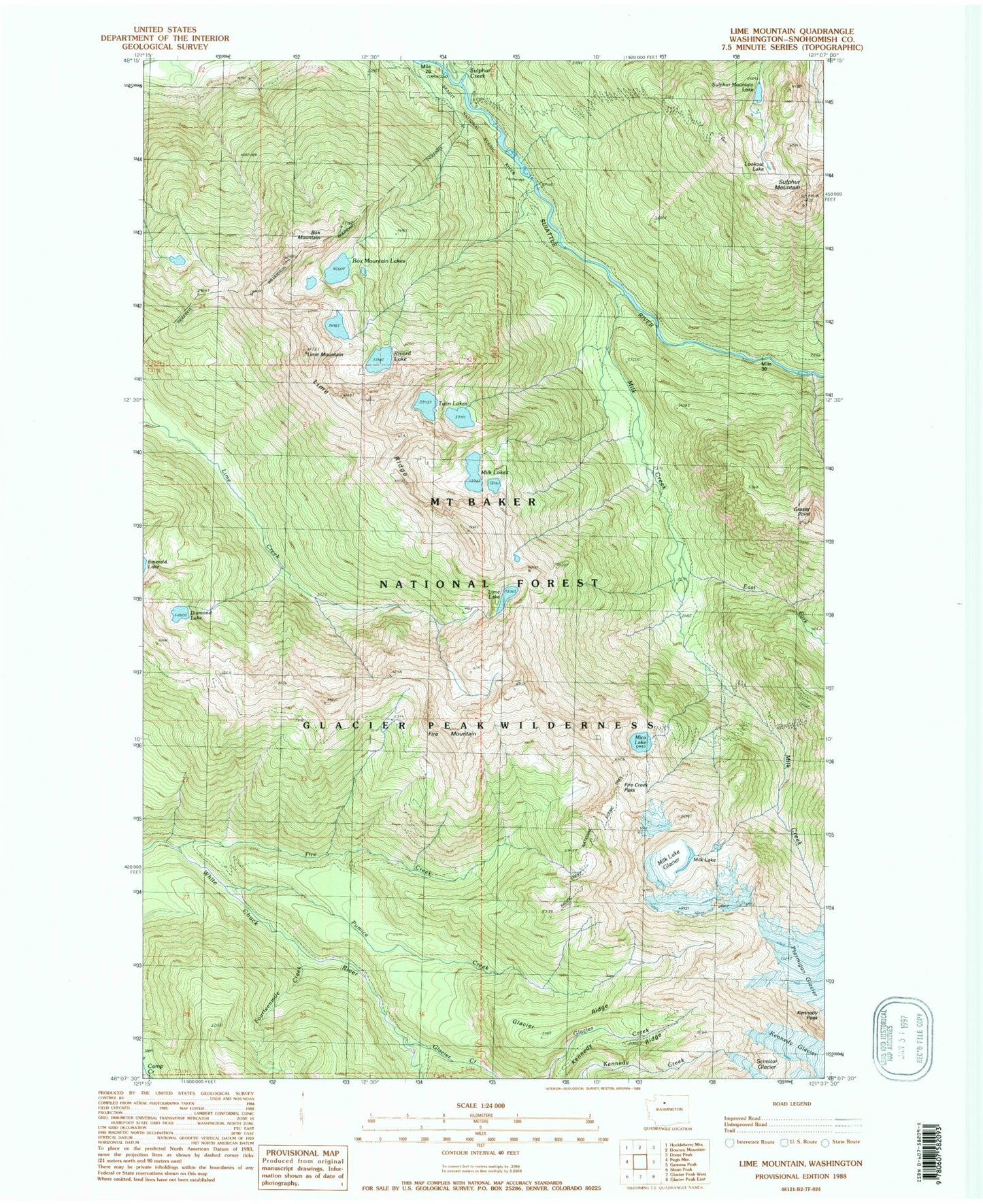
Classic USGS Lime Mountain Washington 7.5'x7.5' Topo Map
Couldn't load pickup availability
Historical USGS topographic quad map of Lime Mountain in the state of Washington. Typical map scale is 1:24,000, but may vary for certain years, if available. Print size: 24" x 27"
This quadrangle is in the following counties: Snohomish.
The map contains contour lines, roads, rivers, towns, and lakes. Printed on high-quality waterproof paper with UV fade-resistant inks, and shipped rolled.
Contains the following named places: Box Mountain, Box Mountain Lakes, Camp Creek Ridge Trail (historical), Diamond Lake, East Fork Milk Creek, Fire Creek, Fire Creek Pass, Fire Creek Trail (historical), Fire Creek Way (historical), Fire Mountain, Fourteenmile Creek, Glacier Creek, Glacier Ridge Trail, Kennedy Peak, Kennedy Ridge Trail, Lime Lake, Lime Mountain, Lime Ridge, Lookout Lake, Meadow Mountain Way (historical), Mica Lake, Milk Creek, Milk Lake Glacier, Milk Lakes, Ptarmigan Glacier, Pumice Creek, Rivord Lake, Sulphur Creek, Sulphur Mountain, Sulphur Mountain Way (historical), Twin Lakes, Buckeye Basin, Milk Lake, Kennedy Ridge, Glacier Ridge, Sulphur Creek Campground, Suiattle Trailhead